








Transcript: 213 tornadoes and counting: Inside Illinois’ record year
Transcript: 213 tornadoes and counting: Inside Illinois’ record year
The 21st Show
213 tornadoes and counting: Inside Illinois’ record year
Read the full story at https://will.illinois.edu/21stshow/213-tornadoes-and-counting-inside-illinois-record-year.
Transcript
// This is a machine generated transcript. Please report any transcription errors to will-help@illinois.edu.

[00:00:00]
Brian Mackey: It's the 21st show. I'm Brian Mackey. This year, Illinois set a dubious record, the most tornadoes ever recorded here at 213. The year is not over yet. That figure from the National Weather Service office in Lincoln. Second place happened just two years ago, and it's not even close. That was 142. So 213 this year, second place, 142. And in fact, three of the top five years for tornadoes in Illinois happened in the last decade. When we talk about tornado alley, we tend to think of Texas, Oklahoma, and Kansas. But do recent events mean that our 21st state should also be on that list? This is the subject of this year's State of Change television special from our colleagues at Illinois Public Media. Let's listen to a clip.

[00:00:49]
Andrew Pritchard: This was a situation that escalated very quickly. Unfortunately, you know, in close proximity to Mattoon-Charleston.

[00:00:56]
Speaker 2: We saw the National Weather Service is still saying a confirmed large and extremely dangerous tornado was located near Westfield [the east] at 45 mph. This new warning is now in effect until 8 p.m. It's still being tagged as a particularly dangerous situation.

[00:01:11]
Andrew Pritchard: Currently sheltering on the north side of Charleston. Uh, where a big tornado just spun up. And I think, I think this tornado has gone through part of Mattoon-Charleston.

[00:01:25]
Brian Mackey: Joining me now to talk more about this are three people who worked on the project. Tinisha Spain is environmental reporter and host of the local PBS show Mid-American Gardener from Illinois Public Media, Abigail Bottar, agricultural and environmental reporter for IPM News, and Andrew Pritchard, meteorologist for IPM, also a storm chaser and photographer. Tinisha, Abigail, Andrew, welcome back to the 21st show.

[00:01:50]
Tinisha Spain: Good morning and thanks for having us.

[00:01:53]
Brian Mackey: Listeners, you can join us today at 800-222-9455. How did this year's tornado season affect you? Uh, maybe you're still dealing with some of the aftereffects. And how are you thinking about the fact that this may be a new normal for us, as we'll hear. 800-222-9455 is the number. 800-222-9455.

All right, Andrew, I'm gonna start with you. Big picture, how are you thinking about the 2026 tornado season in Illinois?

[00:02:25]
Andrew Pritchard: Well, we're always looking for comparisons, and this year certainly seems to stand alone. We've had a series of really active years over the last five, as you just kind of recounted there, but this year was a bit different in that it started early. We had tornado warnings and official tornadoes as early as, uh, you know, the late winter months of February, and it rolled on into March and April with big severe weather outbreaks, and then it didn't stop there. Uh, it continued on into the summer, and these were just a series of really significant outbreaks of damaging tornadoes that were frequently hitting communities. So it was, it was really something to behold.

[00:03:00]
Brian Mackey: You know, as a, as a storm chaser, I know you're often heading out towards the plain states. Did you put more or fewer miles on your vehicle this year?

[00:03:08]
Andrew Pritchard: That is actually a really good question. I think that I was out more days than I typically am, but I probably covered less mileage. I mean, I still got out there. It was, you know, a little bit silly. We get into storm chasing stories here, but I drove all the way to the Canadian border, essentially, on the 8th and 9th of June, saw nothing but sunny skies, and then we came back and the 10th and 11th of June were just prolific tornado days here in the Midwestern states of Missouri, Iowa, Illinois, and Indiana.

So, this was a year where, you know, I never had a year — I guess I should say — where there were so many days where I was headed out, you know, to observe and document severe weather, but was also worried about my own home and prepping my family for what to do when the sirens go off and, you know, kind of helping them through the basement situation and then popping on the air here at WILL. So it was a very busy year and certainly the busiest when it comes to a radius of a couple hours, you know, around my hometown of Champaign Urbana.

[00:04:04]
Brian Mackey: Tinisha Spain, I'm gonna bring you into the conversation now. So, State of Change — the change is climate change, global warming in the title there. The topics in the past have included global warming, prairie preservation and restoration, uh, invasive species, and the role of carbon on our planet. How did tornadoes come to be the subject matter this year?

[00:04:25]
Tinisha Spain: Funny how it developed, it just, it would not be ignored, I guess. We weren't even originally uh going to focus this year's special on weather, on tornadoes. We were looking at data centers because that was sort of a hot button issue and the connection there uh with the environment. So, really we, we were planning to go left and these storms just would not be ignored. And so finally, uh, Reginald Hardwick, our news director, said, we might have to pivot here. And so, um, late spring, we, we did just that, and I'm glad we did because we covered a lot of ground. And this, you know, this, this was the story, um, in central Illinois, and I'm just really glad we were able to capture it. And Andrew's footage and knowledge, um, was just incredible. It made it — made it the character, the main character.

[00:05:14]
Brian Mackey: So Abigail Bottar, I'm going to bring you in now. What does the data say about Tornado Alley and whether it is actually shifting eastward toward Illinois?

[00:05:25]
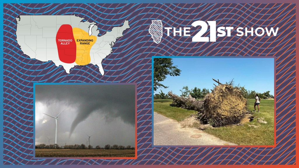
Abigail Bottar: Yeah, so it's kind of complicated because meteorologists will say it's not shifting, it's not expanding. Uh, Tornado Alley on average typically has the most concentrated amount of tornadoes in the country still, even though we're seeing less. Um, so essentially since the late 1970s, we've been seeing less tornadoes in Tornado Alley despite there still being the largest amount of concentrated tornado activity there, and more in Illinois, Iowa, Indiana, um, Louisiana, sort of that southeast part of the country as well. So they're kind of decreasing in Kansas, Oklahoma, Texas, what we consider typically to be Tornado Alley, while meanwhile they're increasing in states like Illinois, which just absolutely got pummeled by tornadoes this year.

[00:06:15]
Brian Mackey: Andrew, what is it about Illinois, um, that makes us, uh, you know, or maybe let's get even more basic. What does it take for a tornado to develop in the first place?

[00:06:25]
Andrew Pritchard: It's a great question. Well, we need a thunderstorm, and specifically we need a rotating thunderstorm to generate these tornadoes. So we, you know, as meteorologists, we love acronyms, and so there's an easy one for severe weather. We're looking for the presence of shear — that's wind shear, that's changing wind direction and speed with height as you go up from the ground to the, uh, middle layers of the atmosphere. Lift, as we need something to kind of make the air rise, maybe a frontal boundary. We often talk about, oh, a cold front's going to sweep through, and along and ahead that, look for storms to erupt. Uh, we need instability — that is kind of that warm, muggy air that you feel, that storm fuel or, you know, instability out there. And then, uh, SLIM, we need moisture. M is the last one there.

So you're getting to geography then when you talk about, you know, why is Tornado Alley located here in the central U.S. from the plains, you know, over to the Midwest, and Illinois certainly part of that conversation. And again, it's just kind of unique geography and, you know, as we come out of the winter into the springtime, the jet stream in the northern hemisphere is at its strongest and most active. And as the jet stream comes sweeping in from the west over the top of the Rockies and into the, you know, the plains in the Midwest, it can spin up areas of low pressure, and those areas of low pressure, they have a counterclockwise spin around them. And so as this area of low pressure is traveling in, you know, say from the plains, we get that southerly flow out ahead of that area of low pressure. You get that warm wind and you can kind of smell it out there. It smells — it smelled like spring yesterday. We had a storm system coming through, but you get that warm humid air, that's gonna be fuel, and then you get a front that comes sweeping through and, and kicks off those storms, and we're just kind of a, a good geographic battleground for those conditions.

[00:08:06]
Brian Mackey: Warm, humid air smells like spring. I always think of the South [farms] if, um, you happen to be in the Champaign, Havana area. If you know, you know.

Uh, we're gonna continue this conversation though about uh the State of Change special from Illinois Public Media, which I should say, uh, is gonna be airing Thursday evening, tonight, on uh, public, uh, public television, WILL TV. Um, it'll also be online after that. Uh, we'll have a link to the show page at our website twentyfirstshow.org, and we'll continue talking with Andrew Pritchard, Tinisha Spain, Abigail Bottar when we return. This is the 21st show. Stay with us.

It's the 21st show. I'm Brian Mackey. We're talking about Illinois's record-breaking year for tornadoes. So far, the National Weather Service has confirmed 213 touchdowns here in the 21st state. Uh, that number could go up and that is again a preliminary number, um, could, could change before the end of the year. Uh, those tornadoes are the subject of this year's State of Change special from Illinois Public Media. State of Change airs Thursday, uh, November 12th, tonight at 7:30 on WILL TV. It will also be on the Illinois Public Media YouTube channel.

We're talking about that and the weather with Abigail Bottar, agricultural and environmental reporter at IPM, Tinisha Spain, environmental reporter and uh host of the TV program Mid-American Gardener, and Andrew Pritchard, meteorologist for, uh, uh, for IPM and a storm chaser and photographer. Uh, you can join us today, 800-222-9455. How did this year's tornado season affect you? Uh, maybe you're still dealing with the cleanup or insurance companies, uh, in your part of Illinois. 800-222-9455 is the number. 800-222-9455.

Andrew, let me ask you, uh, uh, sometimes I wonder if, you know, these numbers go up because we just have so much better radar and other technology to confirm them. Is, is that part of this story? I mean, could it be that we're just seeing more of them because of the, uh, technology we have, or, or do we know that this is actually like, uh, a measurable increase?

[00:10:35]
Andrew Pritchard: So yes and no. It's most certainly part of it that we're more easily able to detect some of these tornadoes both on radar. We've got more people out there with, you know, a camera or, you know, a smartphone in their pocket where they can document and report these. So there is an element of that, but when we look at 2026, this was definitely, you know, the result of a very active storm track that was producing a series of very significant severe weather outbreaks. And so it was not just that we're picking out some of these smaller tornadoes there. I think that was maybe part of the story here in, uh, in 2024 — we had, you know, some of these more widespread storm clusters that were better at picking out some of the tornadoes versus straight-line wind impacts in there, but 2026 was not just a matter of we can see them better. It was, there was a lot more of them, and they were very strong in nature.

[00:11:24]
Brian Mackey: And all right, let's go to the phones. 800-222-9455 is the number. We have Paul calling from Urbana. Paul, thanks for calling in.

[00:11:34]
Paul: Hi, um, I haven't been listening to most of the show and I guess this hasn't been brought up, but, uh, when local meteorologists go mad about how balmy it's been this October, there's no, there's no mention, at least on the media I monitor — on broadcast television in this area, which is nominally a progressive area. There is no mention of climate change, climate chaos, or whatever. I mean, they want to have a feel-good show or something, but it's very distressing for me that the absence of an honest discussion of what's going on, you know, it's still not happening. We've got COP [2] going on and the U.S. isn't participating, and I'm just kind of ranting, but it just seems to me that, uh, I, I mean, even a while back I think there was a pressure campaign to get meteorologists to, to, uh, um, acknowledge climate chaos, and it, it, you know, apparently hasn't worked.

[00:12:37]
Brian Mackey: So I appreciate that. I think we talked with a guy, he was from Boston, maybe he even lost his job for talking too much about climate change in his weather forecast. Andrew, I don't know if you remember that episode or if you were part of that discussion with us. Um, that was a few years ago, just about the pressure. And I mean, you do prepare weather forecasts for our home station, Illinois Public Media. I know it's often more like news you can use than providing the context behind the meteorology, but I don't know if you have thoughts about what, what Paul had to say there.

[00:13:05]
Andrew Pritchard: Certainly, and no, I wasn't a part of that particular episode, but it's tough, you know. As I was going through my undergrad, my professors were telling me, look, you're gonna have to be an expert, or at least be able to talk like an expert, on climate change once you get out there into the real world. And the truth of it is, as a meteorologist, when we're putting together a weather forecast, it's very difficult to say that this storm system is being driven by climate change. You know, today's high of 95 is driven by climate change, or we're going to have a tornado outbreak today that is because of climate change. We have to kind of step back and look at it as a whole.

So I'll say it is difficult as a meteorologist who's going to be communicating the forecast to work climate change into that — it is not necessarily appropriate — but I do champion the idea that we should be talking about it more, you know, on the back end. You know, how did climate change play a role in some of the weather events that we saw here? That's maybe the more appropriate way to go about it. So I see the point there. It's just, it's tough in real time, but I do think that we could all serve, you know, uh, you know, to get together and talk about this more, just so that we understand it better as meteorologists and scientists, and can inform the public then on what's going on.

[00:14:12]
Brian Mackey: Yeah, Chris Gloninger was his name. He's now — or at least at the time we talked to him back in 2024, uh, was a climate scientist at the Woods Hole Group, uh, after having left TV. So we'll, we can, uh, we'll link to that conversation if people want to check that out about just the sort of politicization and how difficult it is to, uh, talk about the weather in the news sometimes for, for some outlets at least.

All right, let's go back to the effects of this year of record tornadoes in Illinois. 213 confirmed by the National Weather Service and counting. Tinisha, being able to survey damage, what did you learn about how to track a tornado's path and the trail it leaves behind, both, you know, physically and metaphorically?

[00:14:56]
Tinisha Spain: So a couple of the shoots that I went out on were just eye-opening experiences, both in terms of when you see the damage that's left behind. We've seen storm damage before, but where were we in Effingham when we were at the golf course there? That was in Charleston, Charleston, and you know, we were on a golf course and you could see the path that this thing just tore through this area. And, you know, everybody doesn't get to walk it with a meteorologist afterward to kind of, you know, see the — but once Andrew explained how the storm moved and how it, you know, went across the highways and literally just peeled these trees up out of the ground, 100-year-old trees with the roots standing, I mean, it just, it really blows you away and puts into perspective, um, just how powerful and dangerous these storms can be.

[00:15:42]
Brian Mackey: Tell me about the Young family home in Danville.

[00:15:45]
Tinisha Spain: Yes, so they live in an area that is really populated by some very old historic trees in Danville, and uh, storms rolled through in June and, you know, just like any other day, her husband was outside, she was inside cooking dinner. Um, and one minute life is normal and the next she is completely surrounded in her home with a tree, um, branches in the house, there's rain, there's insulation, it's completely dark, it's thundering and lightning. You know, just hearing her recount the story was crazy. And then the nightmare of Red Cross coming in and going to a hotel and what can we salvage from our home, and um, just hearing her walk through these incredible months of just figuring it out, um, you know, moving the tree off of their home — that was huge. So you really, it puts into perspective, um, you know, we see these clips on the news, but people actually live this in real time and it takes months to recover.

[00:16:41]
Brian Mackey: Abigail, we spoke during the summer after you had surveyed damage from a tornado that went through Effingham June 17th. Remind us what you saw at the time.

[00:16:50]
Abigail Bottar: Yeah, it was similar to what Tinisha said, just you could see a line of downed trees, downed power lines. Uh, I've never seen anything like it before, and I spent most of the day at the site of this family-owned Corvette parts store and museum, and essentially we know now that it was totaled. At the time, there was still one building standing. The museum part was just completely flattened, and there was just stuff everywhere — for lack of a better word — just pieces of the building and totaled Corvettes everywhere. Um, yeah, so it was, it was really crazy, and, and the owners of this — uh, it's the second-generation owners of this, um, museum and Corvette store — are just very kind people that spoke to so many media that day, including me, and we went back and visited them, um, in August or September for, for the State of Change special just to kind of see how they're doing. And yeah, it's, it may take years for them to fully get back up and operating because, you know, all of their electronics were destroyed, they had to launch a new website, so much of their — I think 60 to 70% of their um, like, products they were selling were destroyed. So, you know, kind of a blessing, the, the owner said, because he was taking over from his dad, to be able to, you know, start some things over and reexamine how their processes work, but then obviously no one wants to be going through a nightmare like that, so.

[00:18:11]
Brian Mackey: Yeah. All right, let's go back to the phones. We have Aya calling from [Niane] on line 2. Aya, thanks for calling in.

[00:18:19]
Aya: Hi, how are you

[00:18:20]
Brian Mackey: today? I'm well. How are you? I understand you were affected not by a tornado but a derecho, straight-line winds, this summer.

[00:18:27]
Aya: Yeah, we, we live [rally]. I run a wedding venue and, um, so we're surrounded by fields and literally we had this gigantic wind and hail, um, golf-ball size, covering everything. Took down seven trees on our property, stripped the fields. I mean, the corn was stripped to a stalk, the beans were stripped to nothing. And to watch the agricultural impact and try to rebound from that — for the farmers losing, you know, millions of dollars around us — um, and how, how do you replant? What do you replant? What, what happens to the ground, all those things. And we were kind of hit with not understanding, like, with insurance we're like, oh we got insurance, it'll cover all our damage, our roof, our this and that, our cars, our campers. And it, it covered some of that, but the property damage that didn't impact was [we expense] and so you're talking $20,000 to repair, take down trees, and you know, that's things that people don't have and don't figure into their living expenses, um, when weather changes like this. And insurance companies aren't going to be uh, as, I don't know what you want to say, you know, that, that's not their deal. And so how is that gonna change our economy and things in this area, um, like when you couldn't get flood insurance, but if you live in a place that floods, you know, those kinds of things that are now changing with the climate change all over. Um, it's gonna really have some big impacts.

[00:20:00]
Brian Mackey: Yeah, I worry sometimes about what we're seeing in Florida right now. It can be very difficult to get insurance depending on where you are, if that sort of thing is going to be coming here to uh, you know, the new Tornado Alley as well. Uh, thank you, thanks so much for, for sharing your experience, [sha]. I appreciate it.

Uh, Tinisha, I don't know if you can speak to this insurance part of the story, if, if that's something you were covering here.

[00:20:19]
Tinisha Spain: That is not a component that I cover, but just anecdotally, um, just listening to the Young story, it was, of course, a nightmare because every step has to be signed off and, you know, they're not in a hurry. You are in a hurry because you are displaced. And so things that take, you know, days, weeks, months, um, really hold up a family moving back into their home. So, even in the best of circumstances, I think just the, the paperwork and just the grind of that still leaves much to be desired when people are, are having a really bad time in their lives.

[00:20:54]
Abigail Bottar: I can talk to the agriculture part of that, because that's something we've been wondering — is if it will be harder to get, um, crop insurance, um, in these areas where there's more tornadoes. And the answer is no, so far. Um, but I did speak to a farmer in August, um, who had really heavy rain on his farm, and he was trying to harvest the corn, and it was right when diesel prices were topping out. And it costs a lot more diesel to harvest corn and soy when the ground is really wet, um, so you have to pay for a lot more diesel to maneuver around your fields. And so he was really lamenting that if that hadn't happened, he wouldn't have more downed corn, he could save some money on diesel. So it just is such a nightmare for uh, farmers and landowners.

[00:21:37]
Brian Mackey: Sometimes things compounding on each other here. Well, just a couple of minutes left, um, safety, right? This is something we talk about a lot, but maybe worth getting a refresher as, as we have dealt with so many tornadoes this year. Uh, Tinisha, I always get uh tornado watches and tornado warnings mixed up. Can, can you help us remember which, which is which there?

[00:21:55]
Tinisha Spain: We had a little fun with this this year, uh, for the first time we do — to some animation. So, uh, look out, we're, we're techie now at State of Change. But, so, uh, watch and warning — and Andrew, feel free to, to jump in here. So watches, the ingredients are there, right? It's, it's a maybe. Uh, pay attention, charge your devices, have a plan. Warning is the severe weather is in the area, it's imminent, correct? So that means get moving, get to your safe space. Uh, do not delay. How did I do, Andrew?

[00:22:26]
Andrew Pritchard: Perfect. Yeah, tornado watch means the ingredients are there. Get ready. Tornado warning means there's a tornado. It's happening. Put

[00:22:32]
Brian Mackey: I guess there's like a tornado emergency now as well, that could — that could

[00:22:35]
Andrew Pritchard: Possibly, there is, yeah. That is reserved for when we've got a tornado that is, uh, you know, confirmed large, dangerous, moving into a populated area. So that is, tornado emergency is very, very — that means we've got a tornado that's, you know, moving into a populated area. And

[00:22:50]
Brian Mackey: Andrew, last question, in just like maybe 30, 45 seconds here. Apps versus radio versus, you know, listening for the sirens out your window — what is the best way in this era of, you know, digital connection to try and stay informed, but knowing that, you know, sometimes cell towers can be knocked out, for example?

[00:23:10]
Andrew Pritchard: Yeah, and so that's multiple ways to get warnings, so you're covering all your bases. I always like to start with have someone that you trust, so, you know, a local meteorologist who knows your area and has dealt with these storms before and knows the different communities and the different nuances in your, your area there. So have a favorite local personality that you can tune to, uh, but also have your phone ready to go. Wireless emergency alerts, those get pushed to you. Uh, the National Weather Service, um, you know, can monitor what they're talking about as well. Keep it tuned to a local TV as well, but yeah, have a variety of ways, and most of all, you know, have somebody that you can trust, uh, to tell you what's going on in your area.

[00:23:49]
Brian Mackey: Well, thank you to Andrew Pritchard, Tinisha Spain, and Abigail Bottar for joining us today. State of Change airs Thursday, this Thursday, November 12th, 7:30 p.m. on WILL TV. You can also check it out after that on the Illinois Public Media YouTube channel. Just search for Illinois Public Media. The 21st show is a production of Illinois Public Media. I'm Brian Mackey. Thanks for listening. We'll talk with you again on Monday.
Transcript Assistance
Illinois Public Media may use AI assistance for transcript generation and/or formatting. Transcripts that have not yet been reviewed for accuracy will be labeled.
To report a transcription error, or to request transcription of archival material, please contact will-help@illinois.edu.