Transcript: Why some of us don’t take weather warnings seriously
Transcript: Why some of us don’t take weather warnings seriously
Weather Realness
Why some of us don’t take weather warnings seriously
Read the full story at https://will.illinois.edu/weatherrealness/why-we-dont-take-weather-warnings-seriously.
Transcript
// This is a machine generated transcript. Please report any transcription errors to will-help@illinois.edu.

[00:00:00]
Speaker 0: The weather and climate often cause concern and curiosity, but understanding the facts behind the phenomena can be a challenge. We're here to help. From the University of Illinois Urbana-Champaign and Illinois Public Media, welcome to Weather Realness, a weekly podcast about the skies above Illinois and the world.

[00:00:30]
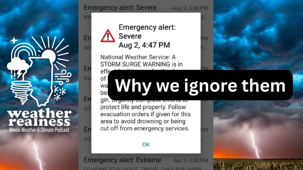
Deanna Hinz: I'm your host, Deanna Hinz, associate professor in the Department of Climate, Meteorology and Atmospheric Sciences at the University of Illinois Urbana-Champaign. Whenever there is severe weather, whether it be a tornado or a line of thunderstorms, we can get many different kinds of notifications on our phone with all kinds of alerts to keep us safe. But let's be real, some of us don't take them seriously.

Over the summer, Illinois has experienced lots of severe weather, including heavy rainfall, violent thunderstorms, and tornadoes. This means many of us have received multiple messages from the National Weather Service warning us about dangerous weather. So how do meteorologists communicate the risk of a thunderstorm to the public? Joining us to take a closer look at how thunderstorm alerts work is Joseph Trujillo Falcon, assistant professor in the Department of Climate, Meteorology and Atmospheric Sciences. Joseph, thank you for joining us today.

[00:01:30]
Joseph Trujillo Falcon: Thanks for having me here.

[00:01:32]
Deanna Hinz: Well, let's get started with thinking about how we get alerts in the first place. What happens behind the scenes before an alert goes to our phones?

[00:01:42]
Joseph Trujillo Falcon: Thank you so much for that question. There's so much deliberation that happens. You know, we primarily start off in the National Weather Service where a lot of forecasters start analyzing various kinds of variables from the atmosphere, from observations to modeling and of course more direct radar output, and really see how the severe weather is evolving in near real time. And when they feel like there's a confidence that something really does need to get warned and people need to be alerted, then they develop different kinds of products to alert and eventually hopefully get you to take shelter.

Among those are severe thunderstorm, tornado watches and warnings, and it really propagates that message outward, and that can reach you from various kinds of locations — from your mobile device to the things you see on television and even social media too.

[00:02:32]
Deanna Hinz: Well, and when they send these alerts out, where do they go? What do they cover? Are they sent to entire counties or just to you, or how does that work?

[00:02:40]
Joseph Trujillo Falcon: So the way they go out disseminating a lot of this information — especially let's focus on mobile emergency alerts — is actually through the Integrated Public Warning System of the United States. And so it gets sent out from the office, it gets directly [distributed] to a bunch of things all at once from mobile devices. Sometimes, you know, you can grab an API and a weather app of your choosing may also grab that and alert you through that medium. It also gets sent directly to communicators that are responsible for getting the message out there, like people on television and things like that.

And so it's all determined on where and how they're issuing that warning. For example, when you think of a tornado warning, they issue a [polygonal] shaded region where the area has the potential, for example, in a warning to develop a tornado, and everybody within that area does receive that message. At least for mobile emergency alerts, it's geo-targeted, so we actually use a lot of our current technologies to kind of go essentially and be more precise of where we are issuing those warnings altogether. And then of course it gets sent to other folks like emergency managers, where they can also ring the tornado sirens that you might hear once a month here in the state of Illinois. And so it really varies, but yeah, it gets sent out to so many mediums all at once.

[00:03:58]
Deanna Hinz: Well, it's really an important point around the geotargeting in particular, because some of our older listeners may remember when maybe a really big area could be warned. Can you talk a little bit about how that has changed over time to be more targeted?

[00:04:14]
Joseph Trujillo Falcon: You know, warnings have a rich history. Even a century ago, weather warnings were not even devoted to weather altogether. It really all started within the context of World War II and a lot of the threats that were happening — more military-related threats and eventually more nuclear threats. So that's really started emerging and really became more of a center point in how the public perceived risk.

People wanted to have these different kinds of emergency alerting systems, and among the very first were those EAS where it was shown on TV and you would stop what you were doing and you would hear that distinct noise — a [*ne ne*] noise. And like, yeah, I'm sure folks remember that too. And I mean it still happens present day across, like, NOAA Weather Radio and things like that. But you know, it really has evolved so much over time where we weren't even meant to warn in terms of extreme weather hazards. Now, as our ability to identify and predict evolved over time, so did our opportunity to finally be able to get a hold of communities, and that's when we started leveraging a lot of this technology to where, yeah, nowadays we can just [geotarget] and give out a warning to a specific geographical region and make sure that people are safe.

[00:05:27]
Deanna Hinz: Can you remind us a bit about the difference between, say, for example, a severe thunderstorm watch versus a warning?

[00:05:34]
Joseph Trujillo Falcon: For sure. And I know that terminology can be a bit confusing at times — even among us meteorologists, sometimes we have to remind each other what that means. And we'll get on that topic of jargon in a little bit. But at least fundamentally, the watch and warning system is meant to give you a heads up in different time scales.

So let's start off with the watch. And let's visualize it in terms of you're making your favorite cupcake. You have all of the ingredients ready to go. The cupcake isn't itself formed yet, but you know, you have the milk, you have the eggs, you have the flour — you have all these ingredients that are there, and eventually it'll result in something, or might result in something, but they're simply there. And that's what a watch is meant to do: give you a heads up hours in advance where severe weather or a tornado threat may be very well possible. And that's meant to — you know, it's not meant to tell you to immediately take protective action — it's telling you to stay vigilant. You know, over the next couple of hours, find your favorite weather source, whether that's a broadcast meteorologist or a mobile app or a social media page, and just stay aware.

And if things do start to evolve rapidly, then they'll issue that warning where I would say something is imminent, and that's where that cupcake is formed in that sort of scenario and you have to take action now — whether it's a severe weather hazard like an extreme wind event or hail, or of course tornadoes, and going to the most central part of your home away from windows. And so that's something that the National Weather Service uses to differentiate and to give you a heads up at different time scales. Because I know our days can get so busy and there's so much going on, it's always good to plan ahead and make sure you have things ready for if something does materialize.

[00:07:17]
Deanna Hinz: Well, I think one thing that's really important to remember too is that, of course, thunderstorms come in different flavors. And so, one of the many things that can be confusing about this is: what's that distinction of "severe" really mean? And how is it understood versus what we maybe as meteorologists may mean by that?

[00:07:40]
Joseph Trujillo Falcon: No, for sure. The National Weather Service defines a severe thunderstorm warning more specifically related to criteria over things related to extreme wind and also to hail as well. But acknowledging that, of course, there are so many hazards happening at once there. You know, I know just in the last month across the state of Illinois and Indiana, there was an extreme wind event that had power outages in significant proportion across both states, and even in Indiana some folks are still trying to find power in that sort of [situation]. And so, you know, when they go out and define severe thunderstorm warnings, they define it more physically related to wind and/or hail and they give a certain threshold for how big the hail needs to be for it to be considered a warning, and how strong the wind has to be.

And so a severe thunderstorm warning is a storm that can produce 58 mph or greater winds and/or 1-inch or larger diameter hail, and that's when it's considered to be severe. But of course, since we have one warning that encapsulates two different hazards, I can understand too why some people may get confused.

[00:08:55]
Deanna Hinz: If you're just joining us, this is Weather Realness, the podcast about weather and climate from Illinois Public Media and the University of Illinois Urbana-Champaign. I'm Deanna Hinz, associate professor in the Department of Climate, Meteorology and Atmospheric Sciences. Today we're talking [about] how we get our thunderstorm alerts with Joseph Trujillo Falcon, assistant professor in the Department of Climate, Meteorology and Atmospheric Sciences.

You know, when we confuse whether a storm is severe or not, or if it's a watch versus warning, what starts to happen when people get confused about the nature of the threat? What are some of the things that the communication science [tells] us about that?

[00:09:40]
Joseph Trujillo Falcon: Social scientists, behavioral scientists, and an emerging field at this intersection of [social science] and meteorology have really gone to explore the cognitive process an individual undergoes when they first receive a warning. They first have to understand what is happening. They also have to believe that that information is accurate and credible, and they then personalize it to their given location and their own experiences, and then they [search] for information or ask informal sources to help make sense of that warning. And only until then will they start to decide.

And when we think of those cognitive steps that people take — if warnings are filled with jargon and we're spending time trying to understand what a watch versus a warning means, or say, in a severe thunderstorm warning that is issued, does that mean wind, does that mean hail, does that mean both? — we're spending valuable time during this cognitive process. Instead of considering taking action, we're now starting to break down these warning products in a moment where really seconds can make a difference between your safety. And so, you know, that's where jargon really kicks in here. It prolongs this warning response process, but in an ideal world, we want to make that as short as possible.

[00:10:54]
Deanna Hinz: Yes, exactly. And I think one thing that even gets even deeper into this jargon issue, of course, is that there's the jargon in a language such as English, for example. But then, you know, there's how well [that] translates into other languages. What are some of the difficulties that can come up around that?

[00:11:15]
Joseph Trujillo Falcon: Yeah, that's a very important point. Even here in the United States — and I want to preface this by saying — already 1 in 5 Americans speak a language other than English at home, and that number's only expected to grow in the coming decades. And when we think about severe weather terminology and most of all jargon, we face a multifaceted challenge.

Let's start off with the fundamentals, but let's not even get into terminology for a second and realize that hazards like tornadoes and hail and extreme winds are not as common in other multilingual countries across the world. And so some folks may not even have a mental framework of what that hazard is in the first place, so we're already [facing that challenge].

But let's say we're trying to translate the word "warning" into Spanish, for example. I've done an extensive amount of research in this area and some of our work has found that there's actually no direct translation of the word "warning." It translates into about six different ways, and each one of those versions carries a different kind of risk perception for the public. And so the more and more jargon we start adding to the mix, the more convoluted the message becomes to multilingual speakers. It's now even harder to consume that weather information, and when we think about that cognitive process that I described before, you know, people are going to take a lot more time understanding what the hazard is, especially if they've never experienced it before. The jargon will only continue to prolong that, and that's why we see a lot of inequities in severe weather contexts and why folks that speak various languages often tend to be underserved in these scenarios. It's because we're not breaking it down in such a way that is accessible and most importantly engaging for these groups.

[00:12:49]
Deanna Hinz: Yeah, well, and I think that's one thing that's so interesting about how much context really matters here. And I think a good example of this is a word that I think a lot more people have become more familiar with than they would like, and that's "derecho." But we experience these types of storms, especially here in the Midwest, but they don't get their own category. You know, we get a tornado warning, we get a hurricane warning, but derechos don't get their own specific one. Can you tell us a bit about why that may be?

[00:13:28]
Joseph Trujillo Falcon: The National Weather Service currently categorizes derechos under severe thunderstorms in general. You know, derechos being that widespread, long-lived windstorm — and as of right now, that can get swallowed into that warning in conjunction with hail. Now, all to say, of course, physically that extreme wind event can also produce hail at the time.

But as of right now, the way we're currently warning is a broader severe thunderstorm warning, and in the warning itself, of course, you're getting more specific and saying what it consists of. But again, when we think about making sure that we get information to people in a fast and more consistent manner, it starts to become a little bit complicated because every severe thunderstorm warning is different. One may have a higher hail risk, one may have a higher extreme wind event, like a derecho risk too. And so again, I admire the work the National Weather Service does to provide us with life-saving information, but I do think in the future we should maybe consider breaking those down into distinct hazards and distinct warnings that say there's an extreme wind event alongside a hail warning, for example. So it's a lot more consumable for audiences and they know exactly what to look out for.

[00:14:39]
Deanna Hinz: If you're just joining us, this is Weather Realness, the podcast about weather and climate from Illinois Public Media and the University of Illinois Urbana-Champaign. I'm Deanna Hinz, associate professor in the Department of Climate, Meteorology and Atmospheric Sciences. Today we're talking [about] how we get our thunderstorm alerts with Joseph Trujillo Falcon, assistant professor in the Department of Climate, Meteorology and Atmospheric Sciences.

So, Joseph, in 2021, the National Weather Service developed three new damage threat categories to communicate the severity of storms. Can you talk about the motivation for that move and why it might be important to distinguish between these storms?

[00:15:21]
Joseph Trujillo Falcon: Of course. The National Weather Service has really been focusing more recently — and they have for a while now — but they've really started to focus on partners and constituents that they serve. You know, when we think about weather, we always like to think about the public that receives this kind of information, but there's so many critical players at hand. For example, folks that make decisions on whether we should continue an outdoor game, all the way out to hospital administrators that must make tough decisions to close down a hospital or move patients right before a tornado. You know, there's so much at stake here.

And the National Weather Service has acknowledged that, and alongside it has evolved the way they communicate warnings. They've moved more toward what they call an impact-based warning framework, where it really is more tailored to meet the societal needs in the most life-threatening weather events. And so giving more detailed [information], emergency managers can then hopefully end up resulting in improved public response and decision making.

And so the way they're doing this, for example, in a severe thunderstorm warning, is they're trying to break it down more easily to folks — and especially in a warning, break it down by different paragraphs — and saying, here's the hazard, here's the source, and here are the certain impacts. For certain hazards, the format also includes event tags at the bottom that specify things like risk level, anticipated damage, and even magnitude. And this sort of information is a little bit better tailored toward those decision makers to help them identify what they need to be looking out for. And so they've implemented these sorts of tags on top of tornado warnings and things like that, where you could have a severe thunderstorm warning with a "destructive" tag or a "considerable" tag, which is kind of an emphasis that the impact of this severe weather event is even greater than what normally is and can hopefully elevate that urgency for people to make those kinds of decisions.

[00:17:16]
Deanna Hinz: [What] is the challenge of alert fatigue? I know that National Weather Service employees and forecasters, they want to avoid too much fatigue happening with these alerts during dangerous storms. Can you talk to us a little bit about what alert fatigue is and whether and/or how this new categorization system can help with that?

[00:17:42]
Joseph Trujillo Falcon: Yeah, no, this has been a very fascinating topic, and as a risk communication scholar, it's been one that my field has debated for quite a while now about what alert fatigue even means. Let's break this down. You know, that "cry wolf" effect has been something that the National Weather Service has always been a little bit worried about. You know, if we issue too many warnings to people, will that desensitize [them], and will that get them to not take our warnings as seriously anymore? At first, that was the big worry across the agency and it's really gotten them to evolve the way they even communicate our products.

But of course, there's been research happening at the same time, and there's actually a current debate going on as to whether the "cry wolf" effect even exists in the warning communication literature. And while that research is still ongoing, I'd love to provide my own take and perspective on this, having done a little bit of research in this area as well, and say — yes and no, actually. And it all boils down to how we define what an alert and what a warning is. Because I know we tend to use those interchangeably, but they're actually two very different terms. When we alert somebody, that is something like a siren or your phone vibrating. It catches your attention, as most warnings do. And that's simply an alert. It just gets you to notice the situation at hand and [understand] that you probably need to do something additionally. But a warning not only alerts you, it instructs you.

And I think that distinction is important because: is there alert fatigue happening as of this moment? Using that definition, yes, there is. A lot of the times we tend to issue warnings that aren't really engaging us and instructing us to do something, and it's not being tailored to our experiences and not relatable. So yeah, if you're going to get a lot of warnings that don't give you that sort of guidance, you're going to be fatigued by that. And that's where a lot of that situation is showing up.

But through interviews with emergency managers, our colleagues have found that a lot of people, when they talk about warning fatigue, it's not necessarily about the frequency of warnings — it's about the frequency of those alerts that don't really instruct and engage you. Now, all credit to the National Weather Service here: they have implemented a Wireless Emergency Alert template that actually holds a lot of the components for a truly effective warning, including the source, hazard, location, guidance, and other types of warning information that make it more effective and more in that warning domain.

But you know, the big argument here has been that, yeah, a lot of folks are fatigued by these alerts that don't resonate with them, that don't engage them. And this is just beyond the Weather Service too — there's a lot of information out there that they may get fatigued with. So I think yes, it's happening, but to a certain extent. You know, people don't get tired of effective and instructive warnings that are tailored to their experiences, but they may get tired of ones that don't really relate to them and don't really give them much to work with.

[00:20:38]
Deanna Hinz: Well, especially to that point, because I think we are existing in a media environment where everything's kind of yelling at us all the time. And so, I just wanted to finish up by asking about what are some of the challenges of alerting people, especially in this more modern media environment, and what are some improvements that we could make to make these more effective?

[00:21:10]
Joseph Trujillo Falcon: You know, when we consider this information ecosystem, we're now introducing new players to the mix that we have traditionally not thought of before. You know, even just a couple of decades ago, the way warnings were usually received came from one authoritative source — whether that's a government official, whether that's the National Weather Service, whether that's a broadcast meteorologist. But now we've really evolved into this decentralized information ecosystem where we can receive [information] from authoritative sources, but not necessarily. It's why, you know, the term was recently coined — "weather influencers" have been really emerging — [people] that may not have direct meteorological experience but do have an extensive amount of reach.

And so I think one of the biggest challenges here in the next few years is really understanding this ecosystem and how people are receiving it and who people see as credible. You know, a lot of the time we equate credibility with a degree. And that is most definitely one factor, but communication research has shown that credibility extends far beyond just a degree. It's how relatable you can be to somebody and other factors as well. And so really studying what credibility means in the context of weather — because are people trusting weather influencers? We have yet to answer that question, but research is emerging on it.

And I do believe that whatever the findings end up showing, we've always had a traditional way that the National Weather Service has warned the public, and it's been through this integrated warning team where we include different partners like emergency managers and other kinds of folks into the mix to help us collectively warn as one. I do think moving into the future, as new players start to come into this space, we should be inviting of them and have these conversations with them and provide them with the tools to make their warnings effective.

Because I do see it a lot on social media — a lot of this alert fatigue happening, a lot of things saying like, "Oh my goodness, this is unprecedented and never done before," just to get a couple more clicks. We need to find ways to better establish expectations for our field and say: how should we be doing this online, and develop best practices? Organizations like the American Meteorological Society have been very [active], and the National Weather Association [has] taken some leadership here in developing those. But you know, as we start reaching new people and start working with new people as well, I really do think that in the next few years we need to focus on these efforts to collectively come up with these different kinds of expectations and also simplify our warnings along the way too.

That National Weather Service Hazard Simplification Program has done an amazing effort across the agency to simplify hazards. And you know, I do agree that operational meteorologists should have like the 60 different categories for different kinds of hazards, or like the 10-plus that they have for floods operationally. But maybe going out to the public, it should be formatted differently, and this Hazard Simplification Program is doing just that. And I do hope that in the future they continue these efforts and really create a warning system that is more engaging, more accessible, and can really get people to take action in the future.

[00:24:18]
Deanna Hinz: Thank you so much for joining us today.

[00:24:19]
Joseph Trujillo Falcon: Thank you so much, Deanna. I always look forward to having these kinds of conversations, and let's just keep up with our warning sources and getting people to stay safe.

[00:24:29]
Deanna Hinz: We've been talking with Joseph Trujillo Falcon, assistant professor in the Department of Climate, Meteorology and Atmospheric Sciences. I'm Deanna Hinz, associate professor in the same department at the University of Illinois Urbana-Champaign. Thank you for joining us on Weather Realness. Do you have a weather or climate question you want us to answer? Leave us a voicemail at 217-333-2141 or email weatherrealness@illinois.edu.

[00:25:00]
Joseph Trujillo Falcon: Weather Realness is produced by Trent Ford, Jeff Frame, Deanna Hinz, Steven Nesbitt, Stephanie Orellana, Eddie Wolf, and me, Joseph Trujillo Falcon. Production is partially funded by the [Barkland] Charitable Trust. This podcast is a partnership between the Department of Climate, Meteorology and Atmospheric Sciences and Illinois Public Media, a service of the University of Illinois Urbana-Champaign. Thank you for listening.

---

**Flags for Human Review:**

- **[00:00:30] / [00:08:55] / [00:14:39] / [00:24:29]** — The host's surname is spelled "Hinz" at [00:00:30] and [00:24:29] in the original transcript, but rendered as "Hince" at [00:08:55] and [00:14:39]. The closing credits at [00:25:00] render it as "Hen." Please verify the correct spelling of the host's surname.
- **[00:00:30] / [00:08:55] / [00:14:39]** — The guest's name is spelled "Trujillo Facon" at [00:00:30], "Trujil Falcon" at [00:08:55], and "Trujilo Falcon" at [00:14:39] in the original transcript. The closing credits at [00:25:00] render it as "Trujillo Falcon." All instances have been standardized to "Trujillo Falcon" based on the closing credits, but please verify the correct spelling.
- **[00:02:40]** — "tri bu ted" in the original transcript appears to be a disfluency or transcription artifact of "distributed." Rendered as [distributed] pending human review.
- **[00:04:14]** — "a ne ne noise" in the original transcript may refer to the Emergency Alert System tone. Rendered as [*ne ne*] pending human review. Please verify the intended phrasing.
- **[00:04:14]** — "no weather radio" in the original transcript may refer to "NOAA Weather Radio." Rendered as "NOAA Weather Radio" pending human review.
- **[00:04:14]** — "geott" in the original transcript appears to be an incomplete or misrecognized word, likely "geotarget." Rendered as [geotarget] pending human review.
- **[00:09:40]** — "mill for information" in the original transcript may refer to "milling" behavior described in warning response literature (i.e., seeking additional information before acting). Rendered as [search] for readability, but please verify the intended term.
- **[00:17:16]** — The host's question beginning with "Is the challenge of alert fatigue" appears grammatically incomplete or may reflect a transcript artifact. Rendered with [What] inserted at the opening pending human review.
- **[00:25:00]** — "Backland Charitable Trust" in the original transcript may be a misrecognition of the funder's name. Rendered as [Barkland] Charitable Trust pending human review. Please verify the correct name of the charitable trust.
Transcript Assistance
Illinois Public Media may use AI assistance for transcript generation and/or formatting. Transcripts that have not yet been reviewed for accuracy will be labeled.
To report a transcription error, or to request transcription of archival material, please contact will-help@illinois.edu.