
Transcript: Storm chasing can be deadly, here’s how to stay safe
Transcript: Storm chasing can be deadly, here’s how to stay safe
Weather Realness
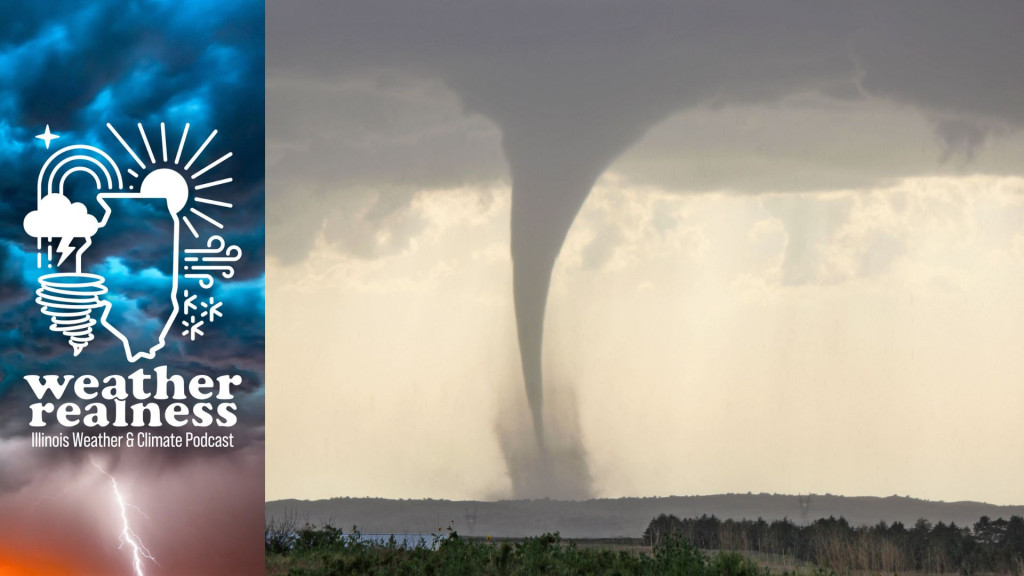
Storm chasing can be deadly, here’s how to stay safe
Read the full story at https://will.illinois.edu/weatherrealness/storm-chasing-can-be-deadly-heres-how-to-stay-safe.
Transcript
// This is a machine generated transcript. Please report any transcription errors to will-help@illinois.edu.

[00:00:00]
spk_0: The weather and climate often cause concern and curiosity, but understanding the facts behind the phenomena can be a challenge. We're here to help. From the University of Illinois, Urbana-Champaign and Illinois Public Media, welcome to Weather Realness, a weekly podcast about the skies above Illinois and the world.

[00:00:30]
Steve Nesbitt: I'm your host Steve Nesbitt, head of the Department of Climate, Meteorology and Atmospheric Sciences at the University of Illinois Urbana-Champaign. Storm chasing can be a dangerous endeavor. It often involves driving thousands of miles to witness the development of severe thunderstorms and tornadoes, which can sometimes be unpredictable. Tornadoes can change direction, accelerate, or even expand in size and overtake vehicles. But storm chasers can be prepared and stay safe through experience. Joining us today to learn more about storm chasing is Jeff Frame, professor in the Department of Climate, Meteorology and Atmospheric Sciences at the University of Illinois. Thanks for joining us, Jeff.

[00:01:10]
Jeff Frame: Thanks for having me, Steve.

[00:01:12]
Steve Nesbitt: So we're going to talk about the storm chasing experience, of course, trying to put people who have never storm chased before into the mindset of what it's like to actually go out and observe these severe storms. So why do people storm chase?

[00:01:28]
Jeff Frame: There are a lot of reasons why. Most people storm chase because they enjoy being near storms. They enjoy photographing them or taking video of them. They enjoy the whole experience. If they didn't think that it wasn't fun, they wouldn't do it. So some folks are photographers and videographers, professional photographers even, taking photographs and video and selling them to media, selling prints on the web. Some folks just do it for the sheer thrill and fun of it. They enjoy driving and road trips and being out on the road, being out in nature, and seeing these majestic storms that nature can sculpt for us. Some folks are more adrenaline junkies, I'll admit that, getting really up close and personal with some of the large hail and some of the tornadoes. Now, I don't do that, but some people do.

Not only me here at the University of Illinois, but several other universities around the country do offer educational programs on storm forecasting and observation, taking students out into the field to learn how to forecast and forecast with consequences. You don't want to end up in the wrong place or on the wrong storm, although sometimes that does happen. And teaching them that if they're, say, at the National Weather Service and somebody sends them a picture of a storm saying it looks like this is going to drop a big tornado, well, is it? And they'll have some idea of storm structure and what they're looking at there. And then some folks do it for science. There are teams out there with mobile radars and other scientific instruments that they deploy around storms to see how these storms work, how tornadoes form, how they persist, how they dissipate, and how they cause damage.

[00:03:19]
Steve Nesbitt: Of course, you and I, Jeff, we both went to school in the 1990s and during that time there were really two big things that I think got a lot of interest in storm chasing. One was the series of Vortex experiments that the National Weather Service and NOAA conducted in the mid-1990s. There were two [failed campaigns] where there was along the same lines as what you see in the movies, these radars that were sort of [grabbing], the fact that you could take these things out on the road and kind of focus on these and then of course. Perhaps as a result of that, or around the same time in 1996, the movie Twister was released.

[00:04:00]
Speaker 3: You've got to get further ahead of it. I know what I'm doing. Have you lost your nerve? Tighten your seat belt. It's at 2 o'clock. It's heading this way. The storm's going to be a lot bigger than we anticipated.

[00:04:16]
Steve Nesbitt: Of course it was a big hit and made storm chasing seem very dramatic and action-packed. I mean, based on your experience, what are some similarities to sort of what is depicted in Twister with the reality of what it's like out there?

[00:04:32]
Jeff Frame: Yeah. So in Twister, if you haven't seen it, basically, a meteorologist who's working now in television goes out to find his soon-to-be ex-wife to serve her with divorce papers. She's a scientist on this team, and during the course of the movie, his love for her rekindles. Both of their love rekindles and they end up getting back together, but in the course of this, they end up chasing several tornadoes, getting hit by a few of them. And stopping for a big meal and to watch a drive-in movie in the middle of all of this. You're not going to be chasing nonstop tornadoes for 24 hours, but there are these teams of scientists out there with some sometimes odd-looking vehicles out chasing the storms, trying to gather data on them. And there are, you know, multiple teams as depicted in the movies, although, you know, none of them are the bad guys like Doctor Jonas Miller, who ends up getting an antenna through his face at the end of the movie.

In real storm chasing, what it's like is, you'll get up in the morning and you'll look at observations and you'll look at our forecast, the forecast models run by NOAA and other agencies and figure out, OK, well, where are the best chance of observable severe storms today, at least that's my take on it because some storms can produce a lot of rain obscuring views of not only a tornado but a wall cloud or the storm structure that makes these things so majestic. Some storms can occur in unfavorable terrain, for example, trees and hills, far southern Illinois, a lot of Kentucky in the Deep South, pretty unfavorable for storm chasing. So you get an idea, well, if I want to go chasing today. You know, where should I go? And what type of storm should I expect? And then, of course, you get in the car and you drive there, you know, maybe stopping for lunch on the way depending on how far you need to drive.

And then usually, if you are on time, you're there before storms form. So you're sitting there maybe in a city park or a Walmart or a gas station with, you know, some friends that you might not have seen for almost a year. And the last time you ran into them was on the side of a road in what a lot of people might call the middle of nowhere. And so here you are kind of reliving that same experience almost a year later. And there's a lot of anticipation during this time. Where's the storm going to form? You know, I don't want to be caught flat-footed, so you're watching radar, you're watching satellite, you're watching surface observations at this point. And then when you think the storm is going up in the right place where you want it to, you drive to it so you can get a view.

Now the first storm that goes up may not be the storm that you want. Sometimes it is, sometimes it isn't, but you have to make that decision. Nobody's going to make that decision for you, and that's part of where experience comes in. Some folks do tend to be a little more impatient and always jump on the first storm. That could put them out of position for something better later. It depends on the setup. I'm not going to say, you know, I can't say, you know, looking at next week, where the best storm might go, it's too unpredictable at this point. And then you observe the storm, you see what it does. And this might be, it might be a very short chase, only an hour or so before the storm either might die or become uninteresting, or you can't keep up with it if it's moving very quickly. But some days if it's a nice slow-moving isolated storm, you might be able to watch that storm for five hours. And those are some of the most enjoyable storm chases that I've had in my almost 20-year career of doing this.

[00:08:30]
Steve Nesbitt: Of course some of the drama in some of the movies are sort of these nocturnal tornadoes that are sort of peering or haranguing the chasers at night. Have you ever been in a situation where you've had to sort of evacuate due to tornadoes hitting later on when you've been storm chasing?

[00:08:48]
Jeff Frame: Yeah, so we always call off our chase at night when I go out with my students here from the University of Illinois, and we spend two straight weeks out on the road, usually out on the Great Plains from the Dakotas all the way to Texas. So that means after each chase, we get a hotel room at night. And because we need several rooms, sometimes I'll make the reservations mid to late afternoon. And there have been occasions where the hotel has gotten rocked by pretty strong thunderstorms. Once, we were in the town of Clovis, New Mexico, that's where our hotel was. We followed a storm into town and I said, all right, we'll just take shelter, let the storm come over us. And then make our way to the hotel.

The hotel was on the side of town that would be closest to a potential tornado, so I did not want to shelter there, so we sheltered on the other side on the west side of town. The storm came over us. We were under a gas station awning. It was the best shelter we could find. We got a lot of small hail, but because the storm was so slow-moving, it did produce a lot of heavy rain, and it took us probably an hour to get from the east to the west side of Clovis, New Mexico, which is a pretty small town. Due to flooding. And as we say, turn around, don't drown, and I think we had to turn around about five or six times before we could finally get back to our hotel, in which case I actually found [steaming] water on the floor of our hotel room and due to all the flooding, the toilet didn't even want to flush right at the beginning. So that was a bit of a situation there.

We've never actually had to take shelter at the hotel. But there have been times where, you know, I'm watching some things and saying, OK, I hope this doesn't come to the hotel and it doesn't. And so that's another thing that I do try to look at a lot more now is trying to get our lodging location in somewhere that won't be really rocked by severe weather, either in the evening or even worse in the middle of the night.

[00:10:58]
Steve Nesbitt: So let's say you're looking at going out to chase here from central Illinois. When do you start planning for a chase?

[00:11:05]
Jeff Frame: Yeah, I mean, our large-scale global weather models can show patterns, you know, possibly favorable for severe weather, you know, sometimes up to a week or more in advance. And that would be the stage where we'd say, OK, severe weather is possible kind of in this area, but there are a lot of details, both in terms of the severe weather threat and the chaseability of a threat that really can't be resolved at that range. And then as the day approaches, maybe within three or four days, you can start seeing a little more about those details. Would storms tend to form a line? Would they tend to remain more supercells, which tend to be a lot more chasable, a lot more visible, a lot of the time. And then, you know, the day before, OK, I think we're going to go chase this. And then, of course, the final decision usually made the morning of. I'd like to wait until about 9:30 in the morning or so, because then we have all our morning weather data in. But if the area is farther away, like say, Omaha, Nebraska, that's a seven-hour drive from here, and you don't want to run the risk of being late.

[00:12:18]
Steve Nesbitt: So do you bring any special equipment other than a camera?

[00:12:21]
Jeff Frame: I do have a GPS logger that I keep hooked up to my computer when I'm out with the students because in case we do lose internet, I'm able to see exactly where we are, which can be very important with navigation. And being able to navigate is also a very important skill here. If you're the type of person who is going to get lost driving from Champaign to St. Louis, you know, without driving directions, that leading a storm chase is probably not for you because those navigational aids, they will, they can lead you into the path of a tornado which is very dangerous. They can lead you into large hail, which is also very dangerous, so you have to be able to kind of chart your own course out there when you're actually on a storm. Now, of course, OK, I want to get to Omaha, fine, Google Maps can do that. But again, once you're there, once you're on a storm, the mapping software doesn't know where the storm actually is.

We do bring some handheld weather instruments out into the field. Some groups do bring weather balloon launching equipment, but because we only have one vehicle, I just don't feel comfortable keeping a tank of compressed gas in the back of a vehicle full of students. If you want to talk about safety hazards, that could possibly be one.

[00:13:47]
Steve Nesbitt: So once you've sort of found a forecast target and you start to see things coming together, how do you decide on which storm you're going to target?

[00:13:57]
Jeff Frame: Yeah, some days that can be really tough. Some days that can be a lot easier. So for example, some days there's just a very, very small area, maybe only a few counties that are favorable for rotating storms and tornadoes. On other days, you might have multiple targets separated by a few hundred miles, meaning that when you wake up in the morning, you have to commit to one of them. If those targets are closer, you can kind of play the middle for a couple hours sometimes. And so that can sometimes be a tough decision.

You look and you might see, well, where, what area has the best wind shear, what area has the most storm fuel or instability we call it. Or looking at the best surface observations. Confidence is another thing. For example, early-day cloud cover and early-day rain can cast uncertainty on whether or not severe storms might form later on in the afternoon. So you might want to take the surest target where, hey, you know, the storm here might not be as good, but I'm guaranteed to get one, or you might want to take a more uncertain target where I'm not sure if storms are going to form, but if one does form, it's going to probably be a pretty good storm. So you have that factor going in there as well.

And then as the afternoon progresses, looking at satellites, seeing where the puffy white cumulus clouds are bubbling up. I'm also hopefully being able to see that yourself. And then, you know, once storms get going, looking at radar and not just looking at low levels but looking at the upper levels of a storm, seeing which storms are getting the highest amounts of rain and hail aloft first. And persisting with that, those are the ones that are going to tend to be longer-lasting and more intense versus some storms just kind of go up. They try, at least you tried, and they collapse on themselves and don't last very long at all.

[00:16:04]
Steve Nesbitt: If you're just tuning in, you're listening to Weather Realness, the weekly podcast about weather and climate. Today we're talking about what storm chasing is like with Professor Jeff Frame, Department of Climate, Meteorology and Atmospheric Sciences at the University of Illinois. So as exciting as storm chasing can be, there are real risks involved. Of course we've seen people at the supermarket with a lot of hail dents in their car, but Jeff, what are some of the dangers of storm chasing and how can people stay safe?

[00:16:29]
Jeff Frame: Yeah, everybody, of course, first and foremost thinks about a tornado. And so to stay safe from tornadoes while storm chasing, number one, you have to stay what we call situationally aware, that is, know where the potential tornado-producing regions of the storm are. And if you lose sight of that or you're not sure where that is, you take your escape route and you bail from the storm. Because no storm is worth putting yourself in danger from that. And as we all know, vehicles, even large vehicles are not safe places for tornadoes. Also, when getting away from a storm, you never want your escape route to cross the potential path of a tornado, and you also want to maintain a safe distance from that, which if a tornado is fast-moving, that means you really should give it a lot more space.

Now when I'm out there with students, we never go right up next to a tornado, because one, that's very dangerous. And number two, when you have maybe a dozen people with you, right, it just takes a lot more time to get everybody back into the vehicle, sitting down, buckled up, and then maybe having to turn out into storm chaser traffic. So we're always at least a few, if not several miles away from these tornado-producing regions of storms.

Lightning is another danger out there. And in terms of storm-related hazards, lightning actually is the one I'm most concerned about because it can really come from anywhere in a storm, and lightning by its nature is very fast. A lightning bolt goes from the cloud base down to the ground at 100,000 mph, that means you don't have time to get out of its way, whereas most tornadoes, you can get out of the way. The hail, if you're experienced, you know where that's going to be, and you can avoid those regions of the storm or drive out of its way, and the hail still isn't going to probably kill you. There's less than one hail death per year in the United States. But lightning can come from anywhere, so remember that for every five seconds between a lightning bolt and thunder, that means the lightning is one mile away. So that's not very far in terms of the storm. So if you see lightning very close, get inside your vehicle, roll the windows up. That is a very safe place to be during lightning as long as you're not touching any electronics, anything plugged into those adapters there in most modern cars.

But the greatest danger with storm chasing is just simply the driving itself. There's only been one day storm chasers have actually been killed by a tornado. That was in 2013.

[00:19:20]
Speaker 4: It's just heart-wrenching to see we had a lot of loss in El Reno. The mayor of El Reno says the loss of lives forever changed this small community. This house is completely gone. Four storm chasers and four others died when the tornado tossed their cars. It's just truly unbelievable. Multiple vortex tornado on the ground. [White] says many more lives could have been lost were it not for the early warnings, an unusual storm track. If it was one more mile over, it would have took the whole community of El Reno out.

[00:19:48]
Jeff Frame: There were four storm chasers who were unfortunately killed. Three of them were very experienced in the same vehicle, but were very close to the tornado. One of them was a lot more inexperienced and actually drove into a rain-wrapped tornado on an interstate. But every other storm chaser fatality has just been due to driving. Once somebody ran a stop sign, killing all occupants of both vehicles, once somebody was driving back from a chase and in clear weather was hit by a drunk driver going the wrong way on an interstate. Once somebody hydroplaned on a wet road, resulting in some fatalities, but those last two, they could just have easily have been driving back from a concert or from a state fair or from visiting family or friends or whatever, and those really, although unfortunate, that's just goes to show you just the dangers associated with driving itself, and that is by far the number one danger associated with storm observation.

[00:20:54]
Steve Nesbitt: And of course there are some parts of the country, for example, near the University of Oklahoma in Norman, where there's a lot of meteorologists out chasing and other people in the public are out as well. That can lead to a phenomenon we call chaser convergence. Can you talk about what that is and how you have to deal with that as a storm chaser?

[00:21:13]
Jeff Frame: You can have hundreds or sometimes even thousands of people on a storm, particularly if it's a well-advertised high-end day. You know, near Oklahoma City, near Dallas, southern Kansas can get like this. And you just have, you know, all these cars trying to follow along with one storm. And the problem's even worse if the storm is moving quickly, meaning that everybody needs to keep driving to stay with the storm. Whereas if the storm is slower-moving, that allows people to pull off the road, stop and watch the storm, greatly actually reducing the amount of traffic on the road and of course allowing people to keep up with it.

But there have been times where we've been stuck in chaser traffic. Once was actually in the same storm that killed those storm chasers. We were watching the storm west of Oklahoma City. We had our escape route planned out, but little did we know that a TV meteorologist would go on the air and basically tell people that if they don't have a below-ground shelter, they need to evacuate and drive south out of the way. And of course that led to a lot of people who just heard that and weren't in any danger, instead drove onto the roads and put themselves in actually a lot more danger than they would have been in, clogging up the roads here and you know, fortunately, the storms that came in afterward did not produce tornadoes, although they could have. And so that was not an extremely fun experience.

So that can be frustrating, but it is part of it. Another thing folks can do is, you know, look into secondary targets. Maybe not, you know, the most likely area, but maybe another area that might not be as popular and we've done that as well, either, you know, usually just out of distance if nothing else, because again, you know, we can't be driving 10 or 12 hours every day. It just gets very grueling to do things like that.

[00:23:17]
Steve Nesbitt: So I guess the take-home message here, Jeff, is that this is something not to be taken lightly. If you wanted to become a storm chaser and go out and observe storms, obviously do your homework, make sure you're prepared, go with someone else and try to follow the rules.

[00:23:31]
Jeff Frame: Yeah, yeah, the best ways to get started, either go with somebody experienced, you know, you can do one of the commercial storm chasing tours. And, or, you know, chase a lower-end severe weather risk with slower-moving storms closer to home. And if you do decide, OK, I want to maybe drive five hours to go storm chasing, do what people call armchair chasing, whereas get up in the morning, look at data, say if I'm going to chase, where would I be? Pick that location, maybe look a couple times during the day, refine that, because, you know, despite, you know, your passion, if you're just always driving four or five hours and always ending up in the wrong spot, you know, that does get frustrating and can burn you out, and that's also expensive in terms of both time and especially with gas prices this year, money, whereas armchair chasing, aside from internet and the cell phone, which you already probably have, is really free. And that can also kind of be rewarding, and I do do that, since my teaching schedule doesn't let me out much in April and early May, but just to keep myself sharp for when my field course does leave.

[00:24:46]
Steve Nesbitt: Well, on that note, thanks for joining us, Jeff.

[00:24:48]
Jeff Frame: All right, and thank you, Steve is my department head. Also, thank you for all your support you've given my storm observation endeavors both on my own and of course with my students.

[00:25:02]
Steve Nesbitt: You're listening to Weather Realness, the weekly podcast about weather and climate. Do you have a weather or climate question you want us to answer? Do you have a question about severe weather or upcoming summer season? What is a burning concern you have about climate here in Illinois? Leave us a voicemail at 217-333-2141 or email weatherrealness@illinois.edu.
Transcript Assistance
Illinois Public Media may use AI assistance for transcript generation and/or formatting. Transcripts that have not yet been reviewed for accuracy will be labeled.
To report a transcription error, or to request transcription of archival material, please contact will-help@illinois.edu.
