
Storm chasers on the reality behind the chase
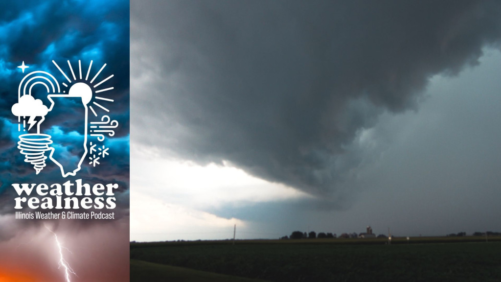
A derecho rolling into Morris, Illinois, which caused widespread damage to trees, powerlines, and buildings on August 10, 2020. Courtesy of Andrew Pritchard
// This is a machine generated transcript. Please report any transcription errors to will-help@illinois.edu.

[00:00:00]
spk_0: The weather and climate often cause concern and curiosity, but understanding the facts behind the phenomena can be a challenge. We're here to help. From the University of Illinois, Urbana-Champaign and Illinois Public Media, welcome to Weather Realness, a weekly podcast about the skies above Illinois and the world.

[00:00:30]
Steve Nesbitt: Welcome back to Weather Realness. I'm Steve Nesbitt, head of the Department of Climate, Meteorology and Atmospheric Sciences at the University of Illinois Urbana-Champaign. Most people take cover in their basements or seek a sturdy shelter when a tornado warning is issued, but some head towards the storm.

[00:00:44]
Andrew Pritchard: Hopefully it's not down behind me, but I think I'm doing myself a favor just blasting east out ahead of this storm right now because I think it's wrapping up to do the thing. There it is, tornado.

[00:00:58]
Steve Nesbitt: That familiar voice is meteorologist Andrew Pritchard while storm chasing on April 3 of this year. He tracked one of the more than 50 tornadoes that touched down in Illinois this year. Andrew's day job is at Nutrient Ag Solutions. He also covers severe weather and gives forecasts on Illinois Public Media. But this time of year you can find him racing down roads. He's widely watched video blog called Sky Drama on YouTube. Welcome back to Weather Realness, Andrew.

[00:01:23]
Andrew Pritchard: Thanks so much for having me.

[00:01:25]
Steve Nesbitt: And also with us is Jeff Frame, professor in the Department of Climate, Meteorology and Atmospheric Sciences at the University of Illinois. He actually takes students into the field each spring to forecast and observe severe thunderstorms. Welcome back, Jeff.

[00:01:37]
Jeff Frame: Thank you, Steve. It's great to be here.

[00:01:39]
Steve Nesbitt: Let's start with you, Andrew. We just heard you during a chase on April 3. Where were you and what did you observe?

[00:01:46]
Andrew Pritchard: Well, back on April 3, I was in a familiar part of the area for folks in central Illinois, kind of in the Interstate 74 corridor between Peoria and Bloomington. We observed a brief tornado near the town of [Hopeale], but this was a long-lived supercell thunderstorm that caused severe weather, produced hail up to 2 inches in diameter as it tracked through that area before it dissipated just north of Bloomington during the late evening.

[00:02:09]
Steve Nesbitt: So let's listen to another tornado that you captured, Andrew. This was in Divernon, Illinois in Sangamon County down by Springfield in July of 2020.

[00:02:20]
Andrew Pritchard: Big tornado. Between the — oh, it's big, it's violent, violent tornado, violent tornado south of [Divernon].

[00:02:34]
Steve Nesbitt: Andrew, describe what you're seeing here, how fast you're going and what were you thinking?

[00:02:38]
Andrew Pritchard: Well, this was a situation that evolved really quickly. It was the day that I was out with my usual chase partner. His name is Colin. He's been my best friend for 20 years. We're very alike, so we agree a lot when we're making these very important storm chasing decisions. And this was a summertime day where we had a lot of instability. It was hot, it was muggy, and there was going to be, you know, an unseasonable amount of wind shear with that setup as well. So we had pretty good confidence we could observe a supercell, maybe a chance for a tornado. These storms erupted during the afternoon. They quickly became severe, but they kind of transitioned into a rainy mess. And we kind of thought, you know, maybe the day is going to be a dud. But we drifted along with the storms and one particular storm just south of Springfield quickly, you know, cleared out, got its act back together and very rapidly produced a pretty significant tornado right in front of us.

So this was a situation that went kind of from zero to 100 quickly. Now, I was not traveling 100 miles an hour down the road or anything like that. I do try to keep it within the speed limit here, but, you know, quickly trying to catch up to this thing because it appeared to be a very intense tornado that was going to be tracking toward the Interstate 55 corridor and some other population centers. So we wanted to make sure that we were reporting this to the National Weather Service so that they could get warnings out and alert folks that this situation was escalating and was at least dangerous at that time.

[00:03:55]
Steve Nesbitt: So we looked up that particular storm and the National Weather Service report said the tornado moved in from Morgan County and dissipated 2.5 miles southwest of New Berlin. Minor crop damage and tree damage occurred in Sangamon County. You know, fortunately a lot of these storms, they don't produce a lot of damage in central Illinois, but some do. Do you remember anything sort of memorable from that particular storm?

[00:04:16]
Andrew Pritchard: Well, what you just listed actually is one of the most memorable parts, or what you just stated there. This was a very big and intense looking tornado, and it was ultimately rated an EF-0 at the very bottom of the scale, and that's because this very big, potentially very strong tornado just tracked through the open soybean and cornfields for the majority of its life. And so it caused no damage, and that's how we rate our tornadoes — based on the damage that they cause.

So it is very true, you know, sometimes you can have these very menacing looking storms, and the way that I as a storm chaser like to observe them is exactly in that way: not causing any damage, not doing any harm to anyone out there. So there was actually a team of researchers who went back out to that damage path the next day to try to do some surveys and get some data on the wind damage there and the wind flow around the tornado. And they found a surprisingly small amount of impacts and damage. There is even the crops were kind of standing back up and getting back to business as usual.

[00:05:15]
Steve Nesbitt: Yeah, so Jeff, what is the most impressive storm that you and your students have witnessed?

[00:05:19]
Jeff Frame: Yeah, so this one goes back to June 16, 2014. That was on our second of two field courses we had that year. And it was looking to be a pretty high-end day up in northeastern Nebraska. And so after a little bit of driving around in circles, we saw a storm go up near the town of Norfolk. It looks like it should be pronounced Norfolk, but it is pronounced Norfolk. And we watched the storm and we came in from the back. We could see through the hook echo — one tornado had crossed the road and began to dissipate off to our north. And then we saw another tornado form a few miles in front of us. And then right next to that another large tornado formed only a couple miles away, and both of these ended up being rated EF-4 on the Enhanced Fujita scale.

Both caused pretty heavy damage near the town of Pilger in northeast Nebraska, and even more unfortunately, both of these did cause a few fatalities. One of these tornadoes would go on to dissipate. The other one continued on, and as we followed the storm northeast, it produced another large tornado, also rated EF-4, and one of the older tornadoes looped around it at over 100 miles an hour and merged in with the circulation. So three instances of multiple EF-4 tornadoes, I think, is going to be pretty tough to beat.

[00:06:42]
Steve Nesbitt: Jeff, what is the reason why scientists chase storms? Is it the thrill or is actual research or both?

[00:06:48]
Jeff Frame: Yeah, it's really actual research. There are teams of mobile Doppler radars. There are some of those based in Boulder, Colorado. There are some Norman, Oklahoma. Texas Tech has some in Lubbock, Texas. And they take these radars out and get close to the storms, which means they're able to gather much more high-resolution data in space and in time than the Weather Service radars are. The Weather Service radars aren't designed for that. And of course they are fixed, so they tend to be a lot farther away from the storms than if you drive the radar to them. And that lets us see how tornadoes form, how they persist, why some tornadoes last for an hour or longer — obviously able to cause a lot more damage if they do that — and able to sense, you know, the lowest 50 or 100 feet of the circulation right down near the ground where friction with the ground becomes a factor, and that's really where tornadoes cause their damage.

[00:07:46]
Steve Nesbitt: You're listening to Weather Realness from Illinois Public Media and the University of Illinois Urbana-Champaign Department of Climate, Meteorology and Atmospheric Sciences. I'm department head Steve Nesbitt and we're talking about storm chasing with Professor Jeff Frame from Illinois and meteorologist Andrew Pritchard. Not all of Andrew's storm chasing videos involve tornadoes. Let's listen to what you were doing on Aug. 10, 2020. Andrew, describe where you were and describe the conditions as that Midwest derecho passed by you.

[00:08:16]
Andrew Pritchard: What happened on Aug. 10, 2020, this was a forecast that really unfolded in the short term, kind of 12 hours leading up to it, where the day before, there was not much in the way of severe weather forecast across the states of Iowa and Illinois. And then 24 hours later, we had the costliest thunderstorm event in U.S. history occur across that exact corridor. So I went to bed the night before, and some of our high-resolution models were starting to depict a thunderstorm cluster developing in western Iowa, tracking that across Iowa during the first part of the day on the 10th of August and then into Illinois during the afternoon and evening. And this particular storm cluster looked very intense, you know, very strong winds, a lot of instability, a lot of fuel out ahead of it. And so I started, you know, having that in my head as I went to bed and woke up early the next morning to start putting together the forecast. And there was this thunderstorm cluster developing very close to Sioux Falls, crossing into northwest Iowa. And over the next few hours as we got to around 9 to 10 o'clock in the morning, this really escalated into a severe situation where we had 100-plus mile per hour wind gusts being detected and observed and measured within this.

And then soon after that, very significant damage reports began coming out kind of, you know, from Des Moines over toward the Cedar Falls and Waterloo area in that corridor — really, you know, 100 to 120 mile per hour winds, a lot of building damage, tree damage, power loss, you know, power outages from downed lines. And so this is the part where there's a couple wires in my brain where I put together a forecast for a big storm, and then I start thinking, well, I would really love to know what that storm's going to look like. I would really like to be there to kind of observe and document this extreme weather event, and then be there on the backside to kind of cover the damage there and go into a bit of a weather journalist, weather reporter kind of mode.

So as the storm was tracking through Iowa, and I kind of finished putting together morning alerts, I got in my car and drove up to northern Illinois, where it looked like this line of storms would blast through in the afternoon. Ended up stopping kind of between Morris and Yorkville on Highway 47. And as this line of storms came through, you could tell that not only there were strong winds there, but it had this look that we're seeing, you know, with some of these windy lines of storms, where there's these little notches or kinks in the line where you know you likely have little spinups or embedded tornadoes.

So I watched this line come in. It was one of the loudest, most intense thunderstorms that I've ever experienced — just an incredible amount of power being released by that derecho, very intense winds that lasted for a long time. You know, there was kind of a very memorable aspect to that. We sometimes on the backside of these derechos, we get what's called kind of like a rear inflow jet and sometimes a wake low on the backside here. And so even two to three hours after the storms passed, I was covering some of the damage from the winds and a couple of these spinup tornadoes in the Yorkville area, and we still had winds that were gusting over 50 mph. So just an incredibly windy situation.

But making my way back home and kind of scouting the damage across northern and central Illinois was just remarkable how widespread the significant damage was — a lot of devastation to farms across the area with flattened crops, but then also, you know, damaged buildings, damaged homes, trees down on homes, very significant wind damage event.

[00:11:36]
Steve Nesbitt: So Jeff, you teach a field course on storm observation and forecasting where you've led students to observe severe convective storms. What has your experience been like teaching students how to observe storms and has that inspired any students to storm chase?

[00:11:50]
Jeff Frame: Yeah, Steve, great question. The students generally love the course. My first time offering it in 2011, I was concerned about, you know, the amount of driving, which we'll get into later. Are they going to be able to, you know, handle driving thousands and thousands of miles? And we pulled up to the storm out in Kansas after leaving Champaign-Urbana and the cumulus clouds are going up and developing into thunderstorms, and I think, you know, these might be the most photographed cumulus clouds in the history of Earth, how excited the students were. And they come back and they say, you know, I think I learned more in that two-week period than I ever have in any kind of similar two-week period in my life because we're basically just looking at the weather. We're not paying attention to the NBA Finals or Major League Baseball or a lot of the news even. We're just out there kind of focused on the weather.

And yeah, some of our students have gone out storm chasing. A couple of them saw the Kankakee tornado earlier this year. Class attendance that day, I'll admit, was pretty bad. But since I do teach every day, unlike Andrew, that does kind of limit my storm observing opportunities kind of through April and early May because I do have commitments here on campus.

[00:13:16]
Steve Nesbitt: So if you're just tuning in, you're listening to Weather Realness, the weekly podcast about weather and climate. Today we're talking about storm chasing with meteorologist Jeff Frame and Andrew Pritchard. Andrew, clearly most people try to avoid these storms, but since you're entering a region that could be risky, what is your best way to maintain your own safety when you're out chasing?

[00:13:38]
Andrew Pritchard: Well, a great way to do that is to put brains together. So I do a fair amount of going out on my own, and sometimes I am alone when I'm observing some of these storms, but I try to be with somebody else, and that's a trusted friend, someone who's been doing this for a long time, so we can kind of have more eyes, a couple of brains. Someone's driving, someone is navigating and making sure that we're looking ahead to the next move there. And that is kind of — that gets into the other part of that, which is just accumulating experience. So we always encourage people who are just beginning to go out with someone else so that, you know, they're helping you make some of these decisions that are very important to your safety and helping explain what you're seeing.

And so you get to a point where, you know, someone like myself or Jeff is out in the field observing a storm, and I know that we don't need to look at radar to know what's going on all the time. It's a nice tool to have there, but you get to a point where you can look at the storm itself in front of you and know what's going on. You see the features, the areas to avoid, how things are evolving. You can kind of get the sense that, uh, this is going in a way I don't like. I'm not very comfortable. We should maybe move. Or yeah, the storm looks like it has a lot of bite, but it's not actually all that severe. So it's accumulating some experience, learning what you're doing out there, so that you can have situational awareness, always making sure you have an escape route, you're thinking ahead, and you're not just kind of out there, you know, as a cowboy having fun looking at a storm. You've got to know that that storm could cause damage. It can harm you, and you need to make sure you're treating it that way.

[00:15:05]
Jeff Frame: And one neat thing I've noticed out in the field is that if you're looking at a storm and you see it strengthening or weakening, that'll often lead what you see on radar by about 10 minutes because the radar only senses the rain falling out of the storm, but of course that rain — the air first has to rise up in the storm, form the rain, and then the rain has to fall back down in order to be sensed by radar. So those visual cues can often be very helpful in anticipating what a storm might do in the near future.

[00:15:36]
Andrew Pritchard: I always kind of say this is a quick thought just to wrap that up, that, you know, a good meteorologist and storm chaser can look at the radar and tell you what that storm is doing. But a great meteorologist and storm chaser can look at the storm and tell you what the radar is going to do. Exactly what you said, Jeff. You can sometimes look at it and say, this storm is intensifying. And that doesn't actually show up on the radar until maybe 10 or 15 minutes later, and you've already made your decision to get into position for that because of that experience and that visual cue that you were able to pick up on.

[00:16:05]
Steve Nesbitt: So in another episode, Jeff, we talked about the role of artificial intelligence in weather forecasting. Do you see that ever playing a role in storm chasing? Will there be one day that models pinpoint exactly the track of a tornado and its strength or the path of a derecho or hailstorm?

[00:16:19]
Jeff Frame: Well, artificial intelligence is already impacting at least severe storm forecasting. There are several different AI models and methods out there. One is run by Professor Russ Schumacher at Colorado State University, where the model's trained on weather patterns and also severe storm reports, because our data we use to train just the AI models can't resolve individual hailstones or tornadoes or anything like that. So saying based on these weather patterns and based on where storm reports have happened in the past, where do you expect severe weather to be based on this future weather pattern? And there are a couple other AI methods out there as well.

But exactly pinpointing the path of a tornado, that I think is a bit of a pipe dream at this point. Small-scale features like thunderstorms and even smaller-scale features like tornadoes offer a lot more limited predictability than something like a hurricane or a blizzard or something like that. Now, derecho, you know, as Andrew mentioned, some of them are quite predictable. Some of them, like the one in 2020, are very unpredictable. So it's possible how we might be able to increase the predictability of those things a little bit.

[00:17:39]
Steve Nesbitt: In addition to covering the weather as it is happening, Andrew also has vlogs about the damage he sees after a violent weather system has moved through. Let's listen to his post from June 29, 2023. Some of you may remember that day, after a derecho moved through central Illinois.

[00:17:55]
Andrew Pritchard: This is unfortunate. It's huge trees. This house got hit hard. There's another tree that fell on it. Gentleman over here said it just took seconds for all this to happen. And these trees are kind of laying from southeast to northwest, which is what got my attention. What a mess.

[00:18:19]
Steve Nesbitt: Andrew, could you describe what you saw after you arrived in Farmer City that day nearly three years ago?

[00:18:25]
Andrew Pritchard: Absolutely, and I had picked out Farmer City as the place I was going to ride this particular storm out. It was another one of these derecho events, one of these big mean windbags. And it was another one of these that had damaging winds, but also little circulations and brief tornado potential. So it looks like a corridor of very intense winds and maybe a spinup tornado was going to move through the Farmer City area. So I got in there just as the storm was beginning to move through town. There was a period of very intense winds. I will say that it was different from the Aug. 10, 2020 event, whereas that 2020 event went on forever. It felt like it was like 20 or 30 minutes of severe winds that just felt relentless. And this June 29, 2023 event was very intense, but the strongest winds were kind of in a three-to-four-minute time frame. So it was very in and then out very quickly.

And so I rode the storm out in the downtown area, which, you know, took some minor damage, but it was as I started moving through the north and east parts of town, closer to where I believe it's Highway 54 runs through town and then meets Interstate 74, and there were a lot of trees down, and unfortunately some of them down on homes or on cars, you know, sometimes bringing down power lines along with them. So there appeared to be a corridor of very intense winds where either a spinup tornado or I think more likely what we call a microburst or one of these burst swaths went through — a very narrow path of intense winds. But, you know, sometimes we talk about a big mean tornado going through the open fields and causing no damage. Well, we can also sometimes get just the unfortunate overlap of a very narrow corridor of intense winds going right through, you know, a small community here in central Illinois. So Farmer City and other communities took a lot of wind damage that day from that storm system.

[00:20:09]
Steve Nesbitt: We talked about AI earlier, Jeff. Are there any future changes in storm chasing that you might anticipate?

[00:20:15]
Jeff Frame: Well, storm chasing has changed a lot over the years. You know, back into the 1990s and early 2000s, before mobile internet, what chasers would do is they would look at weather data in the morning and then they would drive out somewhere and they would have no access to live data on their car phones as they were called in those days. So they might use a pay phone to call somebody, you know, at home in an office, you know, looking at data called the nowcaster. Occasionally they would stop by a public library to use the internet there in a publicly accessible place, and sometimes they descend on National Weather Service offices, but they really wouldn't like that because they're kind of busy with a potential severe weather day and they don't want to have to deal with a horde of storm chasers, most of whom they don't know, begging for data.

So it has become a lot more popular with the first Twister movie, the Storm Chasers show on the Discovery Channel, and then as Andrew mentioned, the advent of streaming on YouTube makes it a lot more accessible to a lot of people, and also the Twister sequel that came out in 2024. So we're seeing a lot more people chasing. I think it will likely continue to get more popular in the future. I think our models will continue to get better as we make investments in science and things like that. But, you know, it's a tough call to say, you know, how things might change.

Last year, some, I think, misled Oklahoma legislators promoted a bill in their House and Senate down there to look at a storm chasing license, and a lot of people did fight that and ended up not passing. I think there were a couple of kind of well-known storm chasers with a TV station down there who were behind that, but ultimately that failed. And the thing is to stop things like that from happening, chasers do need to chase safely, chase courteously, obey the laws, things like speed limits, stop signs, red lights, those basic laws of the road to keep not only other chasers, but everybody else safe, including emergency vehicles as well.

[00:22:25]
Steve Nesbitt: So Andrew, Illinois has had an active tornado season thus far. Does this take a toll on you in terms of always being out? Do you get tired? And is there any indication that our active severe season is going to fall off or shift to other parts of the country?

[00:22:40]
Andrew Pritchard: It's certainly been a busy start to the year, and we've had a series of years with high tornado counts here in the state. So the Midwest has been pretty active a few years in a row here. And kind of the truth of it is every spring is going to be a little bit different, and even two really active springs are going to be different as well, kind of in where they place these active corridors and, you know, when they're active.

So it has been active here, going back to the end of February through March, and then we've had another burst here in the first half of April, and there are certainly some indications as we look out into the forecast for May, June and July that there could continue to be stormy stretches from the plains into the Midwest. So I do kind of, you know, hypothesize or speculate here that we're probably going to continue to see a pretty active season in the Midwest, probably another above-average season. But within all of that, there will be quiet stretches. So it does look like this current active stretch is going to be coming to an end. It looks like maybe the opportunity for some cooler weather, quieter at times here across the Great Lakes, but there's also some pretty big signals that even in the next seven to 10 days that another big push of jet stream momentum could come in across the Southwest. [We may focus] on the southern plains, parts of the Midwest. So kind of a mixed bag answer there. I think that yes, we're looking at probably a continued active pattern here in the Midwest, including in the state of Illinois, but there will be some quiet stretches here as well. It will not be relentless through the rest of the spring on into the summer. We will get our breaks, absolutely.

[00:24:09]
Steve Nesbitt: So we've been talking about chasing storms with meteorologist Andrew Pritchard. He's a meteorologist at Nutrient Ag Solutions in Illinois Public Media. You can look up all his tornado and storm chasing videos on YouTube. Search for Sky Drama, all one word. Also thanks to Jeff Frame, professor in the Department of Climate, Meteorology and Atmospheric Sciences at the University of Illinois. Thank you both for joining us today.

[00:24:30]
Andrew Pritchard: Thanks so much for the invitation.

[00:24:32]
Jeff Frame: Thank you, Steve.

[00:24:32]
Steve Nesbitt: Do you have a weather or climate question you want us to answer? Do you have a question about the severe weather or upcoming summer season? What is the burning concern you have about climate here in Illinois? Leave us a voicemail at 217-333-2141 or email weatherrealness@illinois.edu. Thanks for joining us for this episode of Weather Realness. Our program is produced by Stephanie Orellana, Reginald Hardwick and me, Steve Nesbitt. Weather Realness is produced by Illinois Public Media and the Department of Climate, Meteorology and Atmospheric Sciences at the University of Illinois Urbana-Champaign. Stay safe and we'll talk to you next week.
Tornadoes can leave a path of destruction. Most people try to evacuate or take cover in their basements. But some head straight to the storm.
Storm chasers can come from different walks of life, some are meteorologists, some volunteer for the National Oceanic Atmospheric Administration and others are hobbyists who are drawn to the science and the thrill of the chase.
University of Illinois Urbana-Champaign Department of Climate, Meteorology & Atmospheric Sciences professors Stephen Nesbitt, Jeff Frame and Meteorologist with Nutrient Ag Solutions Andrew Pritchard joins us to explore the world of storm chasing.
Funding for Weather Realness is partially provided by the Backlund Charitable Trust. If you have a question for a local scientist on this program, please leave a voicemail at 217.333.2141 or email weatherrealness@illinois.edu
