Florence Nears Landfall On Carolina Coast, Bringing Storm Surge, Heavy Rain
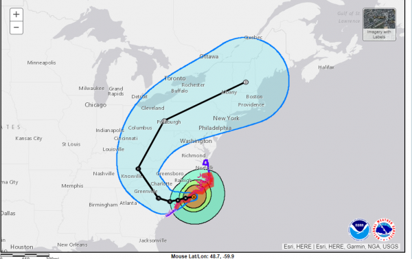
Hurricane Florence will bring "catastrophic flash flooding" to the Carolinas, the National Hurricane Center says. Sustained hurricane-force winds are hitting North Carolina. NOAA/STAR
Hurricane Florence was nearing landfall on the North Carolina coast, bringing with it life-threatening storm surge, heavy rain and sustained winds of 90 miles per hour. Although downgraded to a Category 1 storm, the hurricane has grown larger and slowed its march inland — factors likely to contribute to potentially catastrophic flooding.
More than 280,000 were reported to be without electricity across North Carolina.
"A storm surge of 10 feet above normal levels was reported by the National Weather Service office in Morehead City, North Carolina," reported the National Hurricane Center, citing transportation officials in that state.
Hurricane #Florence is producing a life-threatening storm surge and hurricane conditions over portions of eastern North Carolina. The threat of freshwater flooding will increase and spread inland over the next several days. https://t.co/tW4KeGdBFb pic.twitter.com/3OokbkFeb7
— National Hurricane Center (@NHC_Atlantic) September 14, 2018
"Threat of freshwater flooding will increase over the next several days," read the NHC announcement, which followed warnings issued earlier in the day.
"#Florence is expected to bring a life-threatening storm surge to portions of eastern North & South Carolina, and catastrophic flash flooding and prolonged significant river flooding are likely over portions of the Carolinas and the southern/central Appalachians," the National Hurricane Center said in a Thursday evening tweet forecasting how potentially damaging the storm will be.
North Carolina Gov. Roy Cooper urged his state's residents to expect significant and lasting damage.
"The worst of the storm is not yet here, but these are warning signs of the days to come," said Cooper in a news conference. "Conditions will continue to deteriorate with strong winds, heavy rainfall and extreme storm surges."
The city of New Bern, N.C., reports that some 150 people were awaiting rescue there.
Currently ~150 awaiting rescue in New Bern. We have 2 out-of-state FEMA teams here for swift water rescue. More are on the way to help us. WE ARE COMING TO GET YOU. You may need to move up to the second story, or to your attic, but WE ARE COMING TO GET YOU. #FlorenceNC
— City of New Bern (@CityofNewBern) September 14, 2018
After making landfall near Wilmington, Florence is expected to head west across South Carolina.
A rush of ocean water invaded the streets on the southern end of North Carolina's Hatteras Island on Thursday, according to The Virginian-Pilot's Jeff Hampton, who said arterial roads were at risk of being impassable after water overwhelmed the dunes.

Hurricane Florence is expected to take a westerly and then northerly path as it loses strength over the next few days.
The storm's sheer power is visible in live video from Frying Pan Tower, a onetime Coast Guard light station some 34 miles off the coast of North Carolina. The force of the wind has damaged the U.S. flag on the tower and is causing the ocean to churn.
"Little change in strength is expected before the eye of Florence reaches the coast, with weakening expected after the center moves inland or meanders near the coast," the National Hurricane Center said.
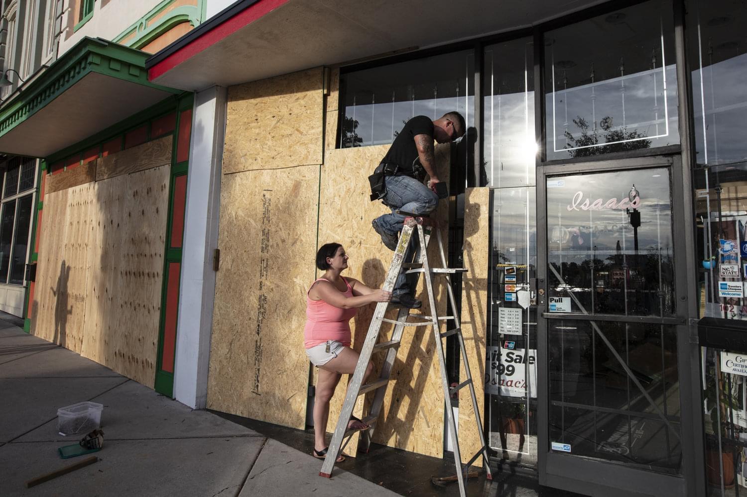
Jacob Harrelson and his wife, Beth, install protective plywood on a local business in anticipation of Hurricane Florence in Wilmington, N.C., on Wednesday.
Despite the drop in wind strength, the most dangerous threat comes from Florence's rains and storm surge, which could bring flooding far inland.
"The larger and slower the storm is, the greater the threat and impact, and we have that here," NHC Director Ken Graham said Thursday. He added later, "Most of the fatalities in these tropical systems is water."
According to the hurricane center's 5 a.m. Friday bulletin, Florence was about 25 miles east of Wilmington, N.C., and about 55 miles southwest of Morehead City. The storm was moving west-northwest at 6 mph with sustained winds of 90 mph.
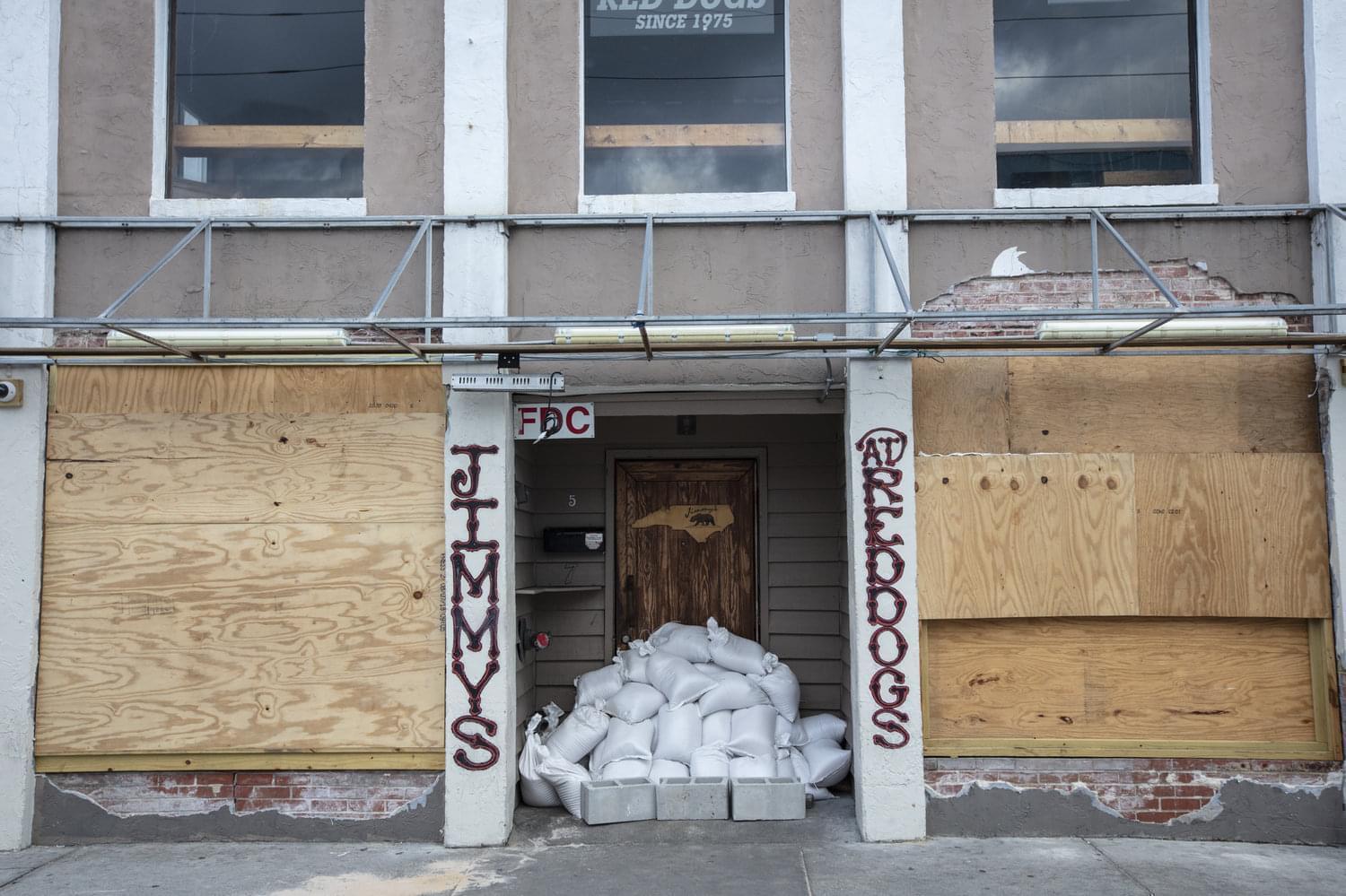
Businesses in Wrightsville Beach, N.C., prepare for Hurricane Florence on Wednesday. Florence has weakened a bit over 24 hours, but it has also grown even larger — and it will most likely dump torrential rain over North and South Carolina through Monday.
According to the NHC website,
"On the forecast track, the center of Florence will approach the coasts of North and South Carolina later tonight, then move near or over the coast of southern North Carolina and northeastern South Carolina in the hurricane warning area on Friday. A slow motion across portions of eastern and central South Carolina is forecast Friday night through Saturday night."
Florence's large wind field will add to the perils as the storm grinds over beaches and inland. Hurricane-force winds extend out for 80 miles and the tropical-storm-force winds reach 195 miles out from the center.
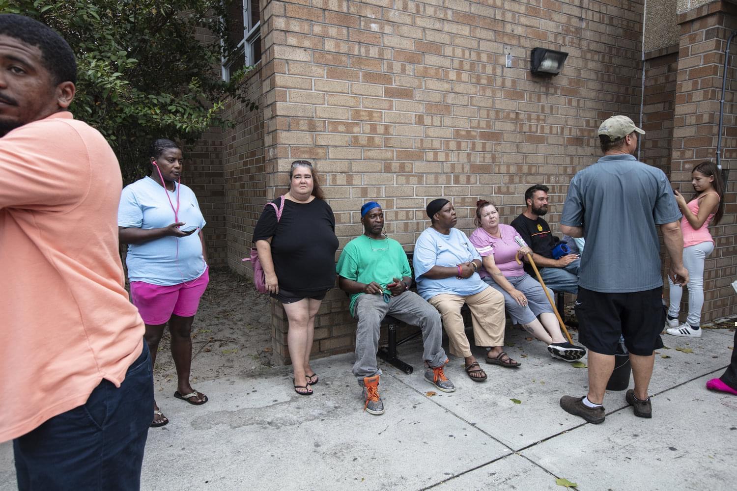
Hurricane evacuees relax Wednesday outside the temporary shelter at Trask Middle School in Wilmington, N.C., ahead of Florence's arrival.
"You're going to have damaging winds for a longer period of time," senior hurricane specialist Stacy Stewart said in an update from the NHC. "So instead of maybe 120 mph winds for 30 minutes, you might end up with 90-100 mph winds for a couple of hours, or three or four hours. And that will produce a lot of damage as well as prolong the beach erosion."
A hurricane warning is in effect for a big chunk of the Carolina coast, from the South Santee River below Myrtle Beach, S.C., to Duck, N.C. — part of the Outer Banks. The warning also includes Albemarle and Pamlico sounds, large bodies of water in North Carolina that could see significant flooding.
Despite the drop in maximum sustained winds, forecasters stress that this hurricane is not to be taken lightly. Hundreds of thousands of people have already evacuated. Officials are urging others in its path to follow suit or to prepare for the worst.
"Do not focus on the wind speed category of #Hurricane #Florence!" the National Hurricane Center said Thursday morning. "Life-threatening storm surge flooding, catastrophic flash flooding and prolonged significant river flooding are still expected.
Eight entire counties and portions of others in North Carolina are under mandatory evacuation orders. Gov.Cooper said he has activated 2,800 National Guard troops to help with storm relief with more personnel on reserve.
In South Carolina, Gov. Henry McMaster said some 421,000 people have evacuated in his state. Virginia has also issued evacuation orders.

Georgia Ramson, 75, sits in front of her house and talks to neighbors in the Northside neighborhood of Wilmington, N.C. Ramson says she is not worried about the storm because she has seen many hurricanes hit the area in her lifetime.
McMaster said the window to flee is rapidly closing. "If you have not left these evacuation zones, you should leave now," he said. "Because time is running out. And remember this — once these winds start blowing at that tropical storm rate, it will be virtually impossible for the rescuers to get in to rescue you."
#Florence is expected to bring a life-threatening storm surge to portions of eastern North & South Carolina, and catastrophic flash flooding and prolonged significant river flooding are likely over portions of the Carolinas and the southern/central Appalachians. pic.twitter.com/j6HZco1Tsc
— National Hurricane Center (@NHC_Atlantic) September 14, 2018
But some residents still say they plan to tough it out.
Vicki Moulson, who teaches at a local community college in the Outer Banks, said she is planning to ride out the hurricane because she wants to be near her home and her friends.
"We're ready; I've been through probably 20 or more hurricanes living down here," she told NPR's Sarah McCammon. "I've been living down here for a really long time, so this one's OK."
Moulson said she initially planned to leave, but as the forecast for Florence weakened and shifted southward, she decided to stay. She said she is worried that if she evacuates, she'll get caught up in the massive flooding that's expected to affect the region. Emergency managers say people in evacuation zones should leave while they can.
Forecasters say Florence will very likely turn to the west-northwest and slow down its forward motion — a situation that will bring even more rainfall to the area. The storm's 5-mph forward speed Thursday evening was a marked drop from Wednesday's 17-mph speeds.
The storm surge — often the most perilous risk to life posed by any hurricane — is expected to inundate areas along the coast with saltwater that's 7 to 11 feet deep, from Cape Fear, N.C., to Cape Lookout, N.C. A surge of at least 4 feet is predicted for a much larger area.
Calling the storm surge prediction "incredible," Graham said that because Florence is likely to nudge its way onto the coast, giving its hurricane winds lots of time to force water inland, he wouldn't be surprised "to see storm surge a mile, a mile and a half inland — maybe even 2 miles or more, in some cases."
The latest rainfall projections warn of 20 to 40 inches of rain from coastal North Carolina into northeastern South Carolina — amounts that could bring "catastrophic flash flooding," the hurricane center said. The rest of South and North Carolina, including cities from Charlotte to Raleigh, can expect 6 to 12 inches of rain — and up to 2 feet in isolated areas, the NHC warned. That forecast area also includes part of southwestern Virginia.
In addition to the hurricane's obvious risks, the National Weather Service says, "A few tornadoes are possible in eastern North Carolina through Friday."
Links
- Live Map: Track Hurricane Florence As It Heads For The East Coast
- Florence Gains Strength As A Category 4 Hurricane, Aiming At U.S. East Coast
- Leaving Home Behind After Hurricane Maria; Comedian Julia Sweeney; Reflecting On Trump’s First Year
- Puerto Rico’s Hurricane Recovery Complicates Ag Businesses’ Seed Research
- Hurricane Maria Makes Landfall In Puerto Rico
- Illinois Utilities Send Help After Hurricane Irma
- Here’s What You Need To Know About Hurricane Irma
- Local Blood And Money Donations Needed For Hurricane Harvey Relief
- Hurricane Harvey Continues Path Through Texas

